


Too large for Zion's east road? Run the 80-mile RV detour test
Measure the travel-ready RV against Zion's 2026 limits, then compare the park's 80- and 161-mile paved bypasses without accepting dirt-road shortcuts.
Too large for Zion's east road? Run the 80-mile RV detour test
By Romana
A campground reservation at Zion does not answer the first route question anymore: can the connected rig legally travel between the East Entrance and Canyon Junction?
Since June 7, 2026, Zion has barred a vehicle that exceeds any one of its published length, width, height or weight limits from that whole section of the Zion-Mt. Carmel Highway.[2] This is no longer a tunnel-escort problem. If one measurement fails, the route through the park fails.
Source credit: RVCamping.info built this measurement gate and entrance-to-entrance route comparison from National Park Service and Utah Department of Transportation pages captured October 28, 2026.
Five measurements decide the route
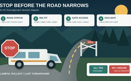
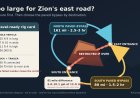
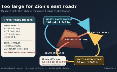
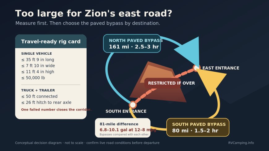
For a motorhome or other single vehicle, the upper bounds are 35 feet 9 inches long, 7 feet 10 inches wide, 11 feet 4 inches high and 50,000 pounds. A truck and trailer gets a different length test: the connected combination may be no more than 50 feet overall, and the trailer's hitch-to-rear-axle measurement may be no more than 26 feet. The same width, height and weight bounds apply.[1]
That produces a five-line rig card for a towable:
| Measurement | Zion bound | What belongs in the measurement |
|---|---|---|
| Connected length | 50 ft | Tow vehicle through the rearmost fixed attachment |
| Trailer hitch to rear axle | 26 ft | Coupler to the trailer's rear axle, not the trailer box label |
| Width | 7 ft 10 in | Widest travel-ready point, including mirrors and attachments |
| Height | 11 ft 4 in | Ground to the highest installed item, including rooftop equipment |
| Weight | 50,000 lb | The road's stated vehicle limit; use documented loaded weights |
NPS specifically tells visitors to include mirrors, tires and add-ons such as air conditioners, bike racks and satellite dishes.[1] A brochure's body width or nominal trailer length is therefore not enough. Record the travel-ready numbers before choosing the entrance.
The restriction starts at Canyon Junction and continues all the way to the East Entrance; it is not confined to the tunnel.[1] Arriving at the tunnel with an old escort plan cannot rescue an oversize route. NPS says an oversize vehicle that reaches either entrance will receive turn-around instructions, subject to limited South Entrance exceptions.[1]
The 80-mile route is the distance default, not an automatic answer
UDOT publishes two paved entrance-to-entrance alternatives for a large vehicle.[3]
| Bypass | Published distance | Published time | Best starting use |
|---|---|---|---|
| South: SR-59, Arizona SR-389 and US 89 | 80 miles | about 1.5–2 hours | Default mileage choice for Kanab, the North Rim or the east side of SR-9 |
| North: I-15, SR-20 and US 89 | 161 miles | about 2.5–3 hours | A route to evaluate when the itinerary already points toward Cedar City or Bryce Canyon |
The northern bypass is 81 miles longer than the southern one, or about 101 percent more distance. At 8 mpg, that difference uses about 10.1 additional gallons; at 10 mpg, 8.1 gallons; at 12 mpg, 6.8 gallons. Those figures compare the two bypasses, not either bypass with the closed-to-your-rig park road. They also exclude grades, wind, idling and side trips.
The route choice still follows the destination. An RV headed from Springdale toward Bryce Canyon may gain little by driving south simply because 80 is the smaller number. An RV headed toward Kanab generally has the opposite geometry. Put the overnight stop and next destination on the map before selecting the lower-mile route.
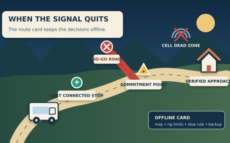
Do not let a map app erase the restriction
UDOT warns that routing software may suggest SR-14 or SR-143 on the northern side; the agency does not recommend those roads as large-vehicle alternatives because of steep grades and sharp curves.[3] On the southern side, Sheep Bridge Road is an unpaved connection with steep sections and is not the published large-vehicle bypass. UDOT also tells large and low-clearance vehicles to avoid the rough Smithsonian Butte and Bench roads.[3]
That leaves a clean route rule: preserve the named highway chain. A shorter line is not a valid substitute merely because an app can draw it.
This is also why the South Entrance exceptions need careful reading. NPS allows an oversize vehicle through that entrance for a short list of south-side purposes, including available large-vehicle parking near the visitor center, a valid Zion Lodge visit, use of Zion Canyon Scenic Drive when the shuttle is not operating, or camping at Watchman or South Campground when open.[1] Those exceptions provide access from Springdale. They do not authorize travel east of Canyon Junction.
A three-branch decision map
1. Does every measurement pass? If yes, the Zion-Mt. Carmel Highway remains an option, subject to current road conditions. If any number exceeds its bound, remove that corridor from the route.
2. Is Zion itself the destination? An oversize rig with a Watchman or South Campground reservation should approach from the South Entrance. Do not approach from the east expecting the reservation to waive the highway limit.[1]
3. Is the trip continuing across the region? Compare the south and north paved bypasses against the next destination. Use the 80-mile southern chain as the mileage baseline, but choose the 161-mile northern chain when it avoids a larger backtrack or fits a Bryce/Cedar City itinerary.[3]
Run one final check on departure day. UDOT's page displayed a fresh construction notice when captured on October 28, so even the correct bypass can acquire a delay or work-zone control. Save the named route, check the current state road notices and carry enough fuel to reject an unsafe shortcut.
The useful cutoff is not “RV” versus “not RV.” It is the first failed measurement on the exact travel-ready vehicle. Once that number fails, plan from the correct entrance and let the next destination choose between 80 and 161 paved miles.
Sources
- National Park Service — Zion large-vehicle restrictions (size tests, measurement scope, affected corridor and South Entrance exceptions; captured October 28, 2026)
- National Park Service — June 7, 2026 restriction announcement (effective date and safety basis)
- Utah Department of Transportation — Zion road restrictions and alternate routes (paved bypass distances, times and roads not recommended for large vehicles; captured October 28, 2026)
What's Your Reaction?