










Blue Ridge Parkway Campgrounds for RVs: Eight Bases Compared by Rig Fit, Services and Access
A rig-first comparison of all eight developed Blue Ridge Parkway campgrounds, including site-level RV and trailer length fields, 2026 Helene closures, dry-camping services, tunnel clearance and the best base for each park district.

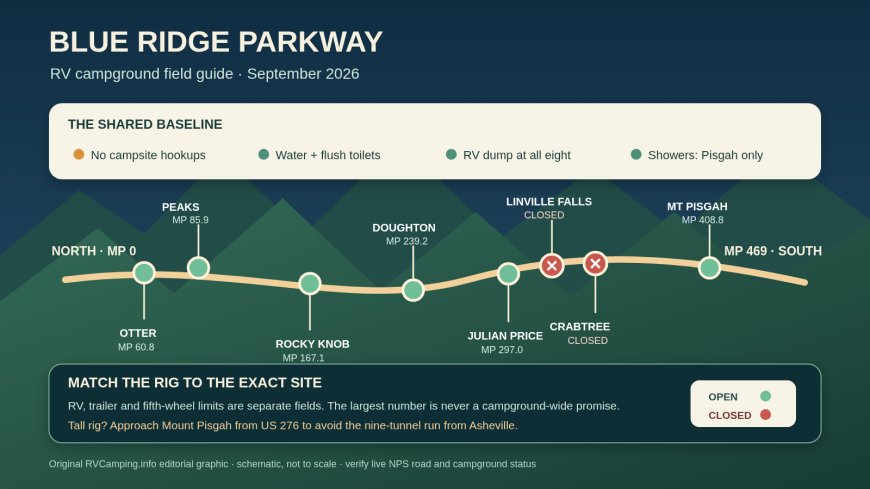
The Blue Ridge Parkway has eight developed NPS campgrounds, but in September 2026 only six are practical booking choices. Linville Falls and Crabtree Falls remain closed for Hurricane Helene repairs.[9][10]
Among the open options, there is no full-hookup winner: every campsite is nonelectric, with shared drinking water, flush toilets and an RV dump station.[1]
Mount Pisgah is the only campground with operating showers this season.[11] Julian Price normally has showers, but its shower house is unavailable in 2026.[8]
For most RV travelers, the choice is geographic. Otter Creek and Peaks of Otter cover the northern Virginia end. Rocky Knob works for the Floyd and Mabry Mill area. Doughton Park is the quiet northern North Carolina base. Julian Price is the useful Blowing Rock and Boone choice, but with sharply reduced 2026 inventory. Mount Pisgah is the high-elevation southern base and the one that demands the most attention to tunnel clearance.
Quick comparison
| Campground | MP | Current 2026 position | Published site-specific equipment lengths* | Hookups and shared services | Best fit |
|---|---|---|---|---|---|
| Otter Creek | 60.8, VA | Open; reservation-only listing | RV entries 18–80 ft; no separate positive trailer lengths published | No hookups or showers; water, flush toilets, dump | James River and creek walks; lower elevation; arrivals from VA 130 |
| Peaks of Otter | 85.9, VA | Open; reservable and first-come inventory | RV entries 18–77 ft; no separate positive trailer lengths published | No hookups or showers; water, flush toilets, dump; general store listed | Bedford, Sharp Top and a north-Virginia Parkway base |
| Rocky Knob | 167.1, VA | Open; reservable and first-come inventory | RV 13–45 ft; trailer 13–38 ft; fifth wheel 20–38 ft | No hookups or showers; water, flush toilets, dump | Floyd and Mabry Mill; travelers who value first-come options |
| Doughton Park | 239.2, NC | Open, with a small number of site closures | RV 17–90 ft; trailer 17–34 ft | No hookups or showers; water, flush toilets, dump | Quiet hiking base; RV-safe approach via US 21 |
| Julian Price | 297.0, NC | Open with limited inventory; reservations only in 2026 | Database spans RV 15–92 ft and trailer 15–92 ft; many records are closed | No hookups; water, flush toilets, dump; showers unavailable in 2026 | Boone and Blowing Rock, only after confirming a live site |
| Linville Falls | 316.4, NC | Closed for Helene-related repairs | Closed-site reference: RV 17–50 ft; trailer 17–42 ft | Normally no hookups or showers; water, toilets and dump listed | Not a 2026 base unless NPS announces reopening |
| Crabtree Falls | 339.5, NC | Closed for Helene-related repairs | Closed-site reference: RV 28–55 ft | Normally no hookups or showers; water, toilets and dump listed | Not a 2026 base unless NPS announces reopening |
| Mount Pisgah | 408.8, NC | Open; reservable and first-come inventory | RV 20–80 ft; trailer 14–32 ft | No hookups; water, flush toilets, dump; showers in loops B and C | Southern high country, hiking and working showers |
Reading the table: These are the positive equipment-length values attached to individual Recreation.gov campsite records, not campground-wide limits. The Virginia values come from the individual Otter Creek, Peaks of Otter and Rocky Knob records.[4][5][6]
The North Carolina values come from each campground's own inventory, not from a blended Parkway limit.[7][8][9]
Crabtree Falls and Mount Pisgah retain their own equipment fields.[10][11]
A zero or missing value means the database does not state a useful length for that equipment type, so it is excluded. The high end belongs to one or a few particular sites in several campgrounds. Never book from the largest number in this table alone.
The rig-length rule that prevents bad reservations
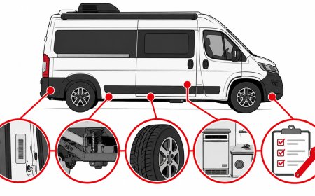
Recreation.gov separates campsite type, permitted equipment and equipment maximum length. Those fields can differ within the same loop. They can also differ by equipment type: a site may publish one value for an RV, another for a trailer, and no positive value for a fifth wheel. Treat each combination as its own fact.
That distinction matters at Doughton Park. Its campsite data include an RV value as high as 90 feet at site A09, while the highest positive trailer value is 34 feet at B64. The 90-foot RV entry does not make Doughton a 90-foot trailer campground. Rocky Knob similarly reaches 45 feet for an RV at selected sites, while its trailer and fifth-wheel records top out at 38 feet.[6][7]
Julian Price needs even more caution. Its underlying database contains 92-foot RV and trailer entries at site B38, yet most campsite records are closed for Helene-related repairs through May 2027. Its active 2026 notice says reservations only, no first-come camping and no shower house.[8] A historical or closed site dimension is useless if that site cannot be booked.
Use this four-part check on the exact listing:
- Enter the equipment type and its actual bumper-to-bumper length in the Recreation.gov search.
- Open the individual site, not just the campground overview.
- Compare the permitted-equipment maximum with the driveway length, entry style, grade and vehicle allowance.
- For a trailer, make sure the tow vehicle has a legal place to park. Do not quietly substitute the motorhome number for the trailer number.
A long driveway does not automatically raise the published equipment limit, and a generous equipment number does not guarantee easy backing. Slides, awnings, trees and the inside swing of a tow combination still matter.
Services: all dry camping, one working shower option
NPS says every Parkway campground has potable water, flush toilets and sinks, and an RV dump station. It also states that there are no campsite hookups. The standard nightly campsite fee is $30, and reservations may be made up to six months ahead.[1] “Potable water” here means shared campground water, not a spigot at the RV.
Mount Pisgah is the clear pick if a campground shower is part of the plan. Its current listing places showers in loops B and C and confirms that electric, water and sewer hookups are unavailable at individual sites.[11] Cell reception is described as minimal, which is worth treating as a planning constraint rather than a pleasant surprise.
Julian Price would ordinarily share the shower distinction, but the 2026 notice closes the shower house and removes first-come camping.[8] Bring a self-contained wash plan and reserve a specific open site.
At Otter Creek, Peaks of Otter and Rocky Knob, the current listings say there are no showers.[4][5][6]
Doughton Park, Linville Falls and Crabtree Falls also list no showers.[7][9][10]
Generators can run from 8 a.m. to 9 p.m. under the current Recreation.gov campground notices.[4][5][6]
Julian Price and Mount Pisgah publish the same overnight prohibition.[8][11] If daily battery charging is essential, check the exact loop and site rules before booking.
Otter Creek: easiest low-elevation Virginia stay
Otter Creek sits at 649 feet, the Parkway's lowest campground elevation. It has RV sites in loop A and tent sites in loop B, with no hookups or showers. All sites are offered through reservations, including same-day booking when inventory remains.[4]
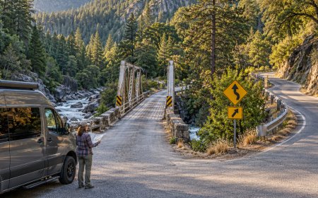
The cleanest RV approach is VA 130. Recreation.gov sends Lynchburg-area travelers west on VA 130 to the Parkway, then one mile north to the campground. The alternate approach from US 60 near Buena Vista leaves about 16 Parkway miles before arrival.[4] As of the September 8 NPS road report, the segment through MP 60.8 is open, but bridge work closes MP 63.5–63.9 farther south.[2] That makes VA 130 the simpler current approach for a large rig.
Choose Otter Creek for James River-area walking, warmer shoulder-season nights and a quieter stop between the Parkway's northern highlands and Peaks of Otter. Skip it if you want mountaintop temperatures, a shower or first-come flexibility.
Check Otter Creek sites on Recreation.gov.
Peaks of Otter: the Bedford and Sharp Top base
Peaks of Otter combines a large RV loop with access from VA 43. Recreation.gov's directions send Bedford arrivals directly up VA 43, with the campground on the left just before the Parkway; Roanoke arrivals can travel about 26 Parkway miles north.[5] The VA 43 approach is the better default for a trailer because it avoids turning a supply run into a long Parkway transit.
There are no hookups or showers. Shared water, flush toilets and a dump station cover the basics, and the facility amenities list a general store.[5] Its individual RV records span modest van-sized limits through a 77-foot value at T41.[5] That top entry belongs to T41, not the whole campground.
Peaks of Otter fits travelers who want Sharp Top, Abbott Lake and Bedford access without moving camp. It is also the more convenient northern Virginia choice for a large motorhome when the exact site supports its length.
Check Peaks of Otter sites on Recreation.gov.
Rocky Knob: best for Floyd and first-come flexibility
Rocky Knob is 1.8 miles south of the Parkway's VA 8 junction and about eight miles from Floyd. Recreation.gov warns that GPS directions may be wrong and should be double-checked.[6] Enter from VA 8 and follow the official milepost approach instead of accepting a rural shortcut.
The campground has water, flush toilets and a dump station, but no hookups or showers. It mixes reservable sites with first-come inventory whose status cannot be tracked online.[6] Its equipment data are more useful than a single headline number: selected RV sites publish 45 feet, while positive trailer and fifth-wheel entries reach 38 feet.[6]
This is the strongest Virginia base for Floyd, Mabry Mill and a flexible arrival plan. It is a weaker match for a long trailer over 38 feet, even when an RV field elsewhere in the campground shows 45.
Check Rocky Knob sites on Recreation.gov.
Doughton Park: quiet country, but ignore the GPS shortcut
Doughton Park is the route-planning trap in this group. Recreation.gov says GPS and mapping programs may route campers onto steep gravel or dirt country roads that are unsuitable for RVs and trailers. Its official approach uses I-77 and US 21, then turns south on the Parkway for ten miles.[7]
The campground itself has the familiar water, flush toilets and dump station, with no hookups or showers. Reservable and first-come sites are represented in the listing, though a few individual sites have hazard-tree closures.[7]
Doughton is a good base for hikers and travelers who want a quieter northern North Carolina stop. For rig fit, read the trailer field separately. The database's standout 90-foot RV value at A09 does not override the 34-foot top trailer entry at B64.[7]
Check Doughton Park sites and official directions on Recreation.gov.
Julian Price: best location near Boone, most complicated inventory
Julian Price is only 4.4 Parkway miles south of the US 321 access from Boone and roughly two miles south of the Blowing Rock connector described in the official directions.[8] That makes it the obvious base for Boone, Blowing Rock, Price Lake and nearby trails.
In 2026, location is the easy part. The campground notice says reservations only, no first-come camping, and no shower house. Recreation.gov's schedules show widespread site closures after Hurricane Helene, so the broad campsite database overstates the inventory a traveler can actually use.[8]
The Parkway itself also has a partial closure from MP 299.9 to 302.8, south of the campground, with a signed detour. The campground approach from US 321 remains on the north side of that project in the September 8 road report.[2] Arrive from Boone or Blowing Rock rather than planning to tow through the closure from the south.
Julian Price is still the best-positioned base for the Boone district when an active site fits. It is not the place to gamble on a walk-up in 2026.
Check live Julian Price inventory on Recreation.gov.
Linville Falls and Crabtree Falls: compare them, but do not plan on them
The current NPS road report says both the Linville Falls campground and its picnic grounds are shut because of Helene damage.[2] Recreation.gov also carries closure schedules through the 2026 operating season with no reopening timeframe.[9] Its RV and trailer lengths remain useful as background for a future season, not as bookable 2026 capacity.
Crabtree Falls is also closed. Recreation.gov says repairs from Hurricane Helene are ongoing with no estimated reopening timeframe, and the NPS road table closes the Parkway around MP 333.9–342.1, which contains the MP 339.5 campground.[2][10] Do not treat an old first-come description or a campsite dimension as evidence that the campground is accessible.
For Linville-area plans this year, Julian Price is the nearest open Parkway base in this comparison, subject to its reduced inventory. For the Crabtree and Mount Mitchell district, use an off-Parkway campground or approach Mount Pisgah from an open corridor rather than trying to tow through the closed section.
Monitor Linville Falls and Crabtree Falls on Recreation.gov, then confirm the NPS road report.
Mount Pisgah: southern high country, showers and tunnel homework
Mount Pisgah sits at 4,980 feet and has working showers in loops B and C, plus water, flush toilets and a dump station. There are no hookups, and cell service is minimal.[11] Those features make it the best developed Parkway base for a cool-weather stay near Asheville when a shower matters.
The approach determines how much tunnel planning you need. Recreation.gov's Asheville directions use NC 191 and then travel about 15 Parkway miles through nine tunnels. The alternate route from Waynesville follows US 276 to the Parkway and leaves only four Parkway miles to the campground.[11]
NPS publishes tunnel clearance at the edge line, not just the taller road center. North of Mount Pisgah, Buck Spring Tunnel at MP 407.3 has a 13-foot-2-inch edge clearance and Little Pisgah Ridge at MP 406.9 has 13 feet 4 inches. NPS tells drivers to stay in their lane and detour when the listed minimum does not clear the vehicle.[3] A legal route never depends on straddling the center line. Measure the RV at its tallest fixed point, including air conditioners and antennas in travel position.
For a tall rig, the US 276 approach is the cleaner default. For a rig whose verified height clears every tunnel on the NC 191 route, the Asheville approach can work, but road status and tunnel clearance both need checking before departure.
Check Mount Pisgah sites on Recreation.gov.
Which base fits whom?
Choose Otter Creek for the James River district and the easiest low-elevation Virginia stay. Choose Peaks of Otter for Bedford and a larger northern Virginia campground. Choose Rocky Knob for Floyd, Mabry Mill and a mix of reservable and first-come camping. Choose Doughton Park for quiet hiking, provided you follow the US 21 approach instead of GPS shortcuts.
Choose Julian Price for Boone and Blowing Rock only after an exact 2026 site is confirmed. Choose Mount Pisgah for the southern high country, working showers and cooler nights, with US 276 favored for tall rigs. Do not choose Linville Falls or Crabtree Falls while the official closure notices remain in force.
The last check belongs at the official sources on the day you leave. NPS warns that weather, construction and emergencies can change Parkway access, and its road table is updated separately from campground inventory.[2] Confirm three things in order: the road segment is open, the campground is operating, and the exact campsite publishes a length for your exact equipment type.
Source credit: RVCamping.info reviewed the current National Park Service Blue Ridge Parkway camping, road-status and tunnel-clearance pages, plus the official Recreation.gov campground records and per-site equipment data for all eight developed campgrounds. Campsite records and road status were retrieved September 9, 2026. Recommendations and the comparison graphic are original RVCamping.info editorial work.
Sources
[1] Camping - Blue Ridge Parkway
[2] Road Status and Closures - Blue Ridge Parkway
[3] Tunnel Heights - Blue Ridge Parkway
What's Your Reaction?