




When Trail Ridge Road closes: the 143-mile RV detour decision
Compare Rocky Mountain National Park’s two published winter detours, calculate the mileage penalty, and use a four-gate RV route check.
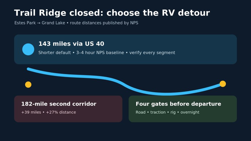
When Trail Ridge Road closes: the 143-mile RV detour decision
By Romana
The winter problem at Rocky Mountain National Park is not finding a clever way around a gate. It is deciding whether an east-side and west-side stay still belong in one itinerary after the direct road disappears.
Trail Ridge Road is normally closed to through travel from about mid-October through late May.[3] The park's alternate-route page puts the shorter Estes Park-to-Grand Lake detour at 143 miles and tells drivers to allow three or four hours.[2] For an RV, that turns a same-park transfer into a mountain travel day.
Source credit: RVCamping.info compared the park's published alternate routes with the current NPS and Colorado DOT road notices retrieved October 27, 2026.
The live pages disagree, so the gate wins
The road-status evidence available on October 27 is a useful warning against trusting one open browser tab. Colorado DOT's Trail Ridge Road page says US 34 is closed between Colorado River Trailhead and Many Parks Curve.[4] The NPS road-status page still says the road is open to through travel, but that page shows a last-updated date of October 6.[1]
That is not a close call to average out. A closure notice from one official road authority means the route is unavailable until a fresher official check resolves the conflict. NPS gives a recorded status line, 970-586-1222, and says the message changes when conditions change.[1] The practical rule is simple: read both current pages, note their timestamps, then call when they conflict.
This article does not treat the dated 2012 alternate-route page as a live road report. It uses that page for the park's published route shapes and mileage, then requires a departure-day check for every highway segment.
Two detours, one clear default
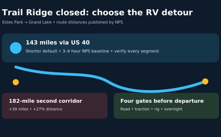
NPS publishes two ways to drive from Estes Park to Grand Lake when Trail Ridge Road is closed.[2]
| Published route | Distance | Extra miles versus the shorter detour | Planning use |
|---|---|---|---|
| CO 7 / CO 72 / CO 119, then US 6, I-70, US 40 and US 34 | 143 miles | 0 | Default starting point when every segment and the exact RV pass current checks |
| US 34 to Loveland, US 287, CO 14, CO 125, US 40 and US 34 | 182 miles | 39 | A second corridor to investigate if conditions or restrictions rule out the shorter route |
The 182-mile option is 27 percent longer than the 143-mile option. At 8 mpg, those extra 39 miles use about 4.9 gallons; at 10 mpg, 3.9 gallons; at 12 mpg, 3.3 gallons. Those are budgeting numbers, calculated as 39 divided by expected mpg. They do not account for idling, wind, grades or a cold engine.
More important, neither line in the table is a promise that a route is suitable today. The shorter route uses US 40, and the park's directions page warns that US 40 can close or carry restrictions in winter.[3] The northern route crosses a different mountain corridor. A longer line on the map is not automatically the safer line.
Use a route matrix, not a scenic-road hunch
Run the two published detours through the same four gates:
| Gate | 143-mile route | 182-mile route |
|---|---|---|
| Every highway open? | Check CO 7, CO 72, CO 119, US 6, I-70, US 40 and US 34 | Check US 34, US 287, CO 14, CO 125, US 40 and US 34 |
| Traction rule met? | Check the exact RV, driven axle, tires and devices against active rules | Run the same check; a different corridor does not remove winter equipment requirements |
| Rig restrictions clear? | Screen height, length, weight, propane and any temporary commercial-vehicle restriction | Repeat for this route rather than carrying over the first result |
| Arrival still sensible? | Allow at least the park's three-to-four-hour baseline, then add weather and stop margin | Add the 39-mile distance penalty before weather margin |
Inside the park, NPS says an active Colorado traction law applies to every vehicle, including four-wheel and all-wheel drive. The page specifies properly rated tires with at least 3/16 inch tread or an approved traction device when the law is active.[1] That wording is for park roads. For the detour, use Colorado's live road service to check the roads actually driven rather than assuming the same status everywhere.
A towable needs two separate questions. First, can the tow vehicle comply with the active traction requirement? Second, do current restrictions affect trailers or the connected combination? Do not reduce that to "the truck has four-wheel drive."
The campsite choice comes before the detour
A 143-mile transfer makes sense when the itinerary has a real west-side objective and a confirmed place to stay. It makes less sense when Grand Lake is merely a second label on a Rocky Mountain National Park checklist.
Use this cutoff:
- Keep both bases if the west-side nights add activities that cannot reasonably be reached from Estes Park, the campground is confirmed open, and the travel-day margin survives a slower drive.
- Stay on one side if the transfer consumes the useful daylight between checkout and check-in.
- Remove the transfer if either detour fails a road, traction, rig or overnight gate. The reservation is not a reason to drive a route that no longer passes.
The last point matters in late October. NPS describes Trail Ridge Road as a seasonal connection between Estes Park and Grand Lake, not a year-round spine.[3] Once it closes, the park functions as two road-access districts. Plan it that way.
Departure-day sequence
- Check the NPS road-status page and Colorado DOT notice. If they disagree, call 970-586-1222 and treat the closure as controlling until resolved.[1][4]
- Open the live Colorado road map and inspect every named segment on the chosen detour.
- Match any traction or vehicle restriction to the exact motorhome or towable combination.
- Recalculate fuel with the chosen route's mileage, not the 48-mile scenic-road distance.
- Check the west-side campground, check-in window and after-dark setup plan.
- Save the route and status numbers before leaving reliable service.
The 143-mile line is the shorter official detour, but it is only the default after every segment passes. If neither route passes, the correct seasonal plan is one base, not a riskier shortcut.
Sources
- National Park Service — Rocky Mountain National Park road status (live-status page captured October 27, 2026; page displayed an October 6 update)
- National Park Service — Alternate routes for Trail Ridge Road (published route mileage and sequence; page last updated March 31, 2012, so not used as a live conditions report)
- National Park Service — Rocky Mountain National Park directions (seasonal closure pattern and US 40 winter qualification)
- Colorado Department of Transportation — Trail Ridge Road scenic byway (closure notice captured October 27, 2026)
What's Your Reaction?