







Before the road narrows: build an RV final-approach call sheet
Build a one-page RV final-approach call sheet using official road status, campground directions, connected rig dimensions, daylight, gate details, a last safe turnaround, and a stop-before-commit decision.

Before the road narrows: build an RV final-approach call sheet
By Romana
The last few miles to a campground can be the part of the trip that deserves the most planning. A highway route may end at a gravel lane with no shoulder, a one-lane bridge, a locked gate, or a fork where the wrong branch leaves no room to turn a trailer around. By the time that problem appears through the windshield, the easy choices may already be behind you.
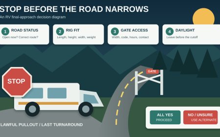
Treat the final approach as its own route. Build a one-page call sheet before departure, confirm it with the campground or managing agency, and choose a place where you will stop for one last check before entering the constrained section. That stop is your commitment point. If the road, gate, daylight, or rig-fit answer is still uncertain there, do not proceed simply because the navigation app says you are close.
A map pin is not an approach plan
Navigation software can take you to coordinates without answering whether the road fits your RV. FMCSA advises commercial drivers to enter relevant vehicle information before a trip, use navigation intended for large vehicles, keep maps current, and obey roadside signs and advisories over the screen.[2] RVs are not commercial trucks, but the planning lesson carries over: a route calculated without the rig's dimensions is only a suggestion.
Official road information adds a second layer. The Forest Service says motorized travel in national forests is limited to designated routes, and that some roads are maintained only for high-clearance vehicles while others close seasonally. It also warns that storms can leave roads blocked by washouts, trees, slides, or rocks and recommends checking with the local office for current conditions.[1]
Neither source replaces the campground's own directions. Put all three on the call sheet: the legal and current road status, the destination's preferred approach, and a route profile that reflects your actual combination.
Start with the complete traveling dimensions
Record the rig as it will arrive, not a brochure's shortest or empty configuration.
- Overall length, including the tow vehicle and trailer, towed car, hitch hardware, racks, or rear cargo.
- Maximum height at the highest fixed point, including air-conditioning equipment, antennas that remain raised, and roof cargo.
- Maximum width, including mirrors and any fixed accessories.
- Gross and axle weights from current labels or scale records, plus any restrictions that matter on the selected roads.
- Ground-clearance concerns, rear overhang, and the places most likely to drag at a crown, dip, or abrupt grade break.
- Drive configuration and road-surface limit: two-wheel drive, four-wheel drive, street tires, or any manufacturer restriction that affects gravel, mud, or steep roads.
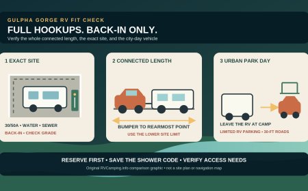
Length deserves two entries: the RV alone and the entire connected combination. A campground may quote a site or parking-pad length while the approach problem involves the tow vehicle, trailer tongue, and turning sweep together. Do not use site fit as proof of road fit.
A current Forest Service page for Junction Campground makes that distinction concrete. It lists parking up to 40 feet for sites 1 through 5, limits sites 6 through 13 to single vehicles no longer than 18 feet, and warns drivers not to take trailers or other large vehicles farther along the narrow gravel campground road.[4] A reservation or nominal pad size cannot overrule an approach warning.
Call the person who knows the last mile
Use the phone number on the official campground, park, forest, county, or reservation page. Ask for someone familiar with arrivals in vehicles like yours. "Can an RV get there?" is too broad. Read the dimensions from the sheet and ask questions that produce a usable route:
- Which road should a rig of this length and height use from the last state or U.S. highway?
- Is any segment one lane, gated, seasonally closed, unpaved, washed out, weight-limited, or unsuitable for trailers?
- Where are the tightest turn, narrowest bridge, lowest branch or structure, and sharpest grade break?
- If two vehicles meet, where can they pass? Does either direction normally yield?
- Is there a turnaround before the campground entrance? If not, where is the last confirmed turnaround?
- Does the gate require a code, key, staff arrival, or a specific entry window? Will the gate physically clear the full combination?
- Are the published directions different from the route suggested by common mapping apps?
- Has rain, fire response, road work, snow, or a downed tree changed the road since the web page was updated?
Write the employee's or ranger's name, office, call time, and exact route sequence. If the answer depends on another road owner, call that agency too. "Probably fine" belongs in the unresolved box, not the approved box.
The National Park Service's Cataloochee notice is a useful example of why the questions need to be specific. It describes a narrow, winding gravel entrance with steep, unguarded drop-offs and warns that drivers may have to stop or back up to make room for oncoming traffic.[3] "Open" tells you less than the passing protocol and road geometry do.
Separate status, suitability, and access
Give each one its own line on the call sheet.
Status asks whether the road is legally and physically open now. Check the managing agency's alerts, closure page, motor-vehicle-use map where applicable, county road notices, and the campground's recorded message. A route shown on a general map may still be closed to public motor travel or blocked after weather.
Suitability asks whether the open road fits this particular rig. Record surface, lane width, bridge limits, overhead concerns, switchbacks, soft shoulders, grades, dips, and the location of passing areas. An open passenger-car road is not automatically a sensible towing route.
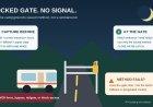
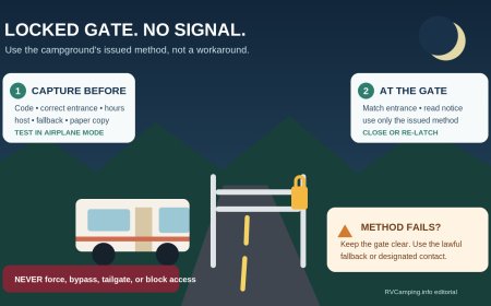
Access asks whether you can get through the entrance when you arrive. Record gate width, gate hours, code or key procedure, check-in deadline, and whom to call if the gate does not open. A code solves a lock problem; it does not create a place to turn around in front of the gate.
Use plain status labels: confirmed, conditional, closed, and unresolved. Include the date and time of every check. Road information ages quickly.
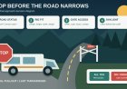
Mark the stop-before-commit point
Choose the last place where the full combination can leave the travel lane, wait without blocking access, and return to the approved alternate route. This might be a fuel station, visitor center, large signed pullout, ranger station, or other lawful lot. Confirm that the lot can hold the rig; do not invent a staging area on a shoulder or at a private driveway.
Record:
- its name, address or coordinates, and entrance direction;
- the distance from that stop to the campground;
- the last verified fuel, cellular service, and restroom options;
- whether the rig can turn around there without backing into traffic;
- the phone numbers for the campground and road authority;
- the alternate campground or holding location if the approach fails.
At the commitment point, stop and compare current conditions with the sheet. Check official alerts again. Call if the weather has changed or the directions conflict with a sign. Walk only where it is legal and safe, and never send a passenger into a blind roadway as an improvised traffic controller.
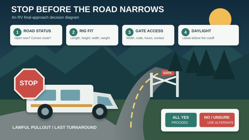
The decision is deliberately simple: proceed only if the named route is open, the destination has confirmed fit for your dimensions, the access method is available, and enough daylight remains for the approach. Otherwise, use the alternate.
Set a daylight deadline, not a sunset target
Darkness removes the visual clues that make a narrow approach manageable: the edge of the traveled surface, low branches, pullouts, ditch depth, gate hardware, and the beginning of a turnaround. Plan to clear the constrained segment in daylight, with margin for a slow drive and one delay.
NOAA's sunrise/sunset calculator accepts a location, date, time zone, and daylight-saving setting, and it notes that a different date must be entered rather than assumed from the current one.[5] Use the destination's coordinates and local civil time. Then work backward from sunset:
- Estimate the slowest reasonable drive time from the commitment point.
- Add time for a phone recheck and an unhurried inspection of the entrance.
- Add a buffer for meeting traffic, road work, livestock, or a missed turn.
- Make the resulting time the latest departure from the commitment point.
This is a planning cutoff, not a claim that the road becomes unsafe at a universal number of minutes before sunset. Tree cover, canyon walls, weather, and the driver's comfort can make the usable window shorter.
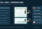
Copy this approach-road call sheet
| Field | Trip entry |
|---|---|
| Campground and reservation | Name, site, confirmation number |
| Official destination contact | Office, phone, hours |
| Road authority contact | Agency or county, phone, alerts URL |
| Approved approach | Turn-by-turn sequence from the last major highway |
| Road identifiers | Highway, county road, forest road, gate name |
| Current status | Confirmed / conditional / closed / unresolved; checked time |
| Surface and geometry | Pavement or gravel, lane count, shoulders, turns, dips, grades |
| Passing plan | Pullout locations, yielding guidance, one-lane segment length |
| Gate plan | Width, hours, code/key/staff procedure, after-hours contact |
| Rig profile | Connected length, RV length, height, width, weight notes, drive type |
| Turnaround points | Last confirmed turnaround and any turnaround at destination |
| Stop-before-commit | Lawful staging location, approach direction, coordinates |
| Daylight cutoff | Sunset, planned departure from commitment point, buffer |
| Abort triggers | Closure, conflicting sign, poor surface, wrong gate, lost daylight |
| Alternate | Campground or lawful holding location, route and contact |
| Verification record | Names, offices, dates, times, and unresolved questions |
Keep a paper copy where the passenger can read it and an offline copy on a device. The route card is not permission to ignore a closure or sign. It is a record of what you verified and a prompt to stop when reality no longer matches the plan.
The arrival decision
A final approach is ready only when five answers are yes:
- The official route is open to your vehicle class now.
- The campground or agency has confirmed the preferred approach for your connected dimensions.
- The gate and arrival procedure will work at the planned time.
- A lawful commitment point and a usable alternate are identified.
- The rig can leave that point early enough to finish the constrained section in daylight.
Any no sends you to the alternate. An unresolved answer does the same until someone with authority can resolve it. Turning around at a large lot may feel conservative. Discovering that there is no turnaround after the pavement ends is much worse.
Sources
What's Your Reaction?