













How to check RV crosswinds and high-wind closures before departure
A conservative predeparture workflow for matching NWS wind forecasts to exposed route segments, checking DOT restrictions and deciding when to wait or reroute.

Source note: This guide uses National Weather Service, WYDOT and WSDOT primary sources. Forecasts, alerts and road restrictions can change after you check them. The current official notice, posted sign, law-enforcement direction, your RV and chassis manuals, and the driver's judgment control.
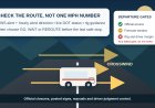
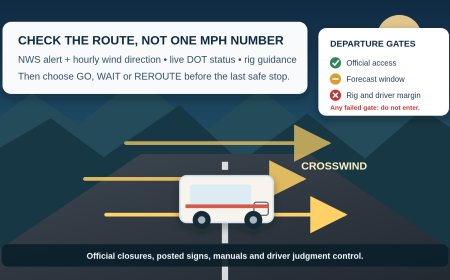
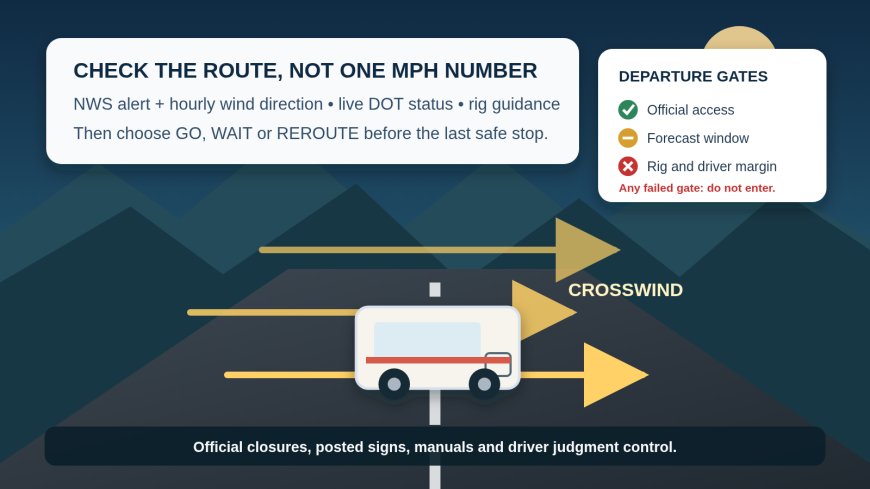
Do not reduce a wind decision to one weather-app number. Before an RV moves, check the National Weather Service alert for every exposed part of the route, open the NWS hourly forecast at those locations, then check each state DOT's live map for closures and vehicle-specific restrictions. Compare the forecast wind direction with the road's direction. If an official restriction covers the rig, the route is closed to that rig. If the forecast, rig guidance or driver's comfort leaves a meaningful doubt, wait or use a checked alternate.
There is no honest universal "safe RV wind speed." A short motorhome, a tall fifth wheel and a lightly loaded travel trailer do not present the same side area, weight distribution or handling. Roads also differ: an open plain, a cut through terrain and a floating bridge can react very differently to the same forecast. WSDOT says wind direction can force the Hood Canal Bridge to close at a lower sustained wind speed when traffic is being affected.[5] That is a useful warning against treating any mph figure as portable from one rig or road to another.
Build a wind sheet for the route
A city forecast is too blunt for a long RV travel day. Split the route into wind checkpoints before opening the forecast:
- exposed plains and desert stretches;
- bridges, causeways and high viaducts;
- ridges, passes and gaps;
- canyon mouths and terrain transitions;
- segments where the highway changes direction;
- the last town, rest area or legal parking area before each exposed stretch.
For each checkpoint, record the route number, endpoints, planned arrival window, road direction, nearest NWS forecast point, state DOT status page, last safe place to wait and a separately checked alternate. A useful entry is "I-80 westbound, Rawlins to Walcott Junction, 9–11 a.m., exposed east-west segment," not "Wyoming in the morning."
Do this for both directions of a round trip. A route that gives a headwind outbound can present a crosswind after a turn or on the drive home.
Read the forecast in the right order
1. Start with the alert, not the daily icon
Open the NWS point forecast near each wind checkpoint and read the active alerts. A High Wind Watch means strong winds are possible; a High Wind Warning means they are happening or expected, while a Wind Advisory also calls for driving caution. NWS states that local offices issue these products using local criteria.[1]
That last detail matters. Do not take a criterion seen on one forecast-office page and promote it into a national RV rule. Read the actual alert for the route. Note:
- affected area and route corridor;
- start and end time;
- expected sustained wind and gust language;
- wind direction;
- impact wording for travel or high-profile vehicles;
- update and expiration time.
Also check for severe thunderstorm, dust and winter-weather products. The hazard may be brief or may combine wind with poor visibility or slick pavement. A wind-only checklist should not hide those other stop reasons.
2. Open the hourly graph at the exposed segment
The NWS Hourly Weather Graph can show an hourly forecast up to seven days ahead and lets the reader select weather elements and the time period.[2] Use it to match the wind window to the time the RV would actually reach the checkpoint.
Write down sustained wind, gusts and direction for the full crossing window, plus a buffer before and after. Do not select the calmest single hour and assume the RV will hit it. Fuel stops, traffic and construction can shift arrival. If the forecast rises sharply near the planned time, moving the departure a little later may move the rig into worse conditions.
Check more than one point on a long exposed leg. Terrain can make a forecast at the departure town a poor stand-in for a ridge, gap or bridge 60 miles away.
3. Translate direction into exposure
Forecast wind direction describes where the wind comes from. Compare that arrow with the road's direction at each checkpoint:
- wind roughly along the road is mainly a headwind or tailwind;
- wind roughly across the road creates the strongest crosswind component;
- a diagonal wind has both components;
- a road bend can turn a headwind into a crosswind within minutes.
This is a screening tool, not a promise about vehicle stability. Terrain, buildings, passing trucks and bridge openings can create abrupt changes that a forecast grid cannot resolve. Mark segments with a near-perpendicular forecast as more exposed, then let official warnings, rig instructions and driver judgment decide the trip.
Check the DOT layer separately
A weather page does not tell you whether the road agency has closed a bridge or barred a class of vehicle. Open the official 511 or DOT page for every state on the route. Search by route and read the full notice, not just the map color.
Look for these terms:
- closed to high-profile or light high-profile vehicles;
- weight-based wind closure;
- no trailers or advise no light trailers;
- extreme blow-over risk;
- partial closure or one-direction closure;
- no unnecessary travel;
- bridge closure.
WYDOT's definitions show why the exact wording matters. A partial closure can bar trailer traffic or light high-profile vehicles while leaving the road open to others.[4] Its weight-based wind closures consider vehicle weight along with wind speed, roadway orientation and geometry.[4] On its separate wind page, WYDOT expressly includes recreational vehicles and camper trailers among eligible vehicles for these restrictions.[3]
If a notice lists a weight, confirm what the agency means by that weight. Do not substitute the trailer's dry weight, a brochure estimate or the tow vehicle alone. WYDOT, for example, defines the posted figure for its system as gross vehicle weight at that time, including the vehicle, people and contents.[3] Other states may define restrictions differently.
A road shown as open to cars is not automatically open to the RV. Conversely, the absence of a closure is not an agency statement that the trip is safe for every rig. WYDOT warns that sensors may not sit at the location with the strongest winds and tells drivers to use judgment even when they are permitted to proceed.[3]
Bridges deserve their own status check. WSDOT provides a live status page for Hood Canal Bridge and explains that the bridge may close as conditions warrant, including at a lower sustained wind speed depending on direction and its effect on traffic.[5] The bridge's published operating details belong to that bridge; they are not a threshold for an RV elsewhere.
Use the lowest controlling limit
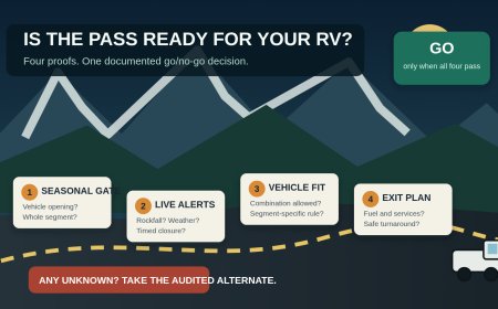
Run the decision through five gates. A failure at any gate means do not enter the exposed segment.
Gate 1: Official access
Stop or reroute if the DOT, 511 notice, gate, sign or law-enforcement direction closes the road to the RV's vehicle class, weight or configuration. "Passenger cars are moving" does not override an RV, trailer or high-profile restriction.
Gate 2: Official weather warning
Wait or reroute when an NWS warning tells people in the affected corridor to take shelter or avoid hazardous travel. Treat watch and advisory language as a reason to reassess the time, route and rig rather than as permission to continue. The alert's stated impacts and instructions control.
Gate 3: Rig instructions
Check the motorhome or trailer manual, chassis or tow-vehicle manual, tire and hitch instructions, and any operator guidance from the manufacturer. Follow the most restrictive applicable instruction. If the manuals provide no mph limit, that silence is not a limit and not proof that any wind is acceptable.
Gate 4: Driver margin
The driver must be rested, comfortable and able to hold lane position without repeated corrective steering. A driver who already felt pushed around on a sheltered approach should not use the exposed bridge or plain as an experiment. WYDOT recommends pulling over at a safe rest area, parking area or town when wind makes the vehicle hard to control, regardless of weight or shape.[3]
Gate 5: Escape plan
Before entering, identify a legal place to wait before the segment and another after it. Confirm that the alternate is suitable for the full RV combination. If the next chance to stop is an exposed shoulder, the plan has too little margin.
Use three verdicts:
- NO-GO: an official closure or instruction applies; a rig manual excludes the condition; the driver cannot maintain comfortable control; or there is no safe waiting or alternate plan.
- WAIT/REROUTE: no formal closure applies, but an alert, near-perpendicular gust window, deteriorating trend, uncertain vehicle classification or poor escape options leave unresolved risk.
- GO, RECHECK REQUIRED: official pages show access, no applicable warning or restriction controls, rig instructions are satisfied, the driver is comfortable and safe pull-off options are identified. This is a time-limited decision, not a guarantee.
This framework deliberately has no universal mph cutoff. The controlling answer comes from the exact rig, location, official products and driver, not a number copied from another RV owner's rule of thumb.
Make three checks, then set a trigger
Check once during planning, once the evening before, and once immediately before departure.
At the final check, record the timestamp and write one sentence:
Depart only if [NWS checkpoints] remain outside controlling warnings, [DOT segments] remain open to [exact RV configuration], [manual conditions] are met, and the driver remains comfortable; otherwise wait at [safe location] or take [verified alternate].
Set a recheck trigger as well: a named fuel stop, state line or last town before the exposed segment. Save official phone numbers and screenshots for weak-signal country, but refresh the live page when service is available. A saved page proves what you saw earlier; it does not prove the road is still open.
If the status changes while moving, the passenger can check it. A solo driver should stop in a legal, protected place before handling a phone. Never wait on a narrow shoulder simply because the forecast looked better farther ahead.
A sample departure decision
Suppose a travel trailer is scheduled to cross an exposed east-west corridor late in the morning. The hourly graph shows a rising north wind and gusts during the planned window, so the wind is broadly across the road. The NWS alert mentions hazardous travel for high-profile vehicles. The DOT page has not yet posted a formal closure, but the only safe waiting area is in the departure town.
The conservative verdict is WAIT/REROUTE. The absence of a closure does not cancel the alert, the crosswind exposure or the lack of a safe mid-segment refuge. The crew checks a later window and the alternate from town. If the DOT later posts a trailer or high-profile restriction, the verdict becomes NO-GO under Gate 1.
Change one fact: the forecast eases before departure, the alert expires, the DOT confirms the route is open to the exact combination, the manuals add no restriction, and the driver is comfortable. The result can move to GO, RECHECK REQUIRED, with another check at the last town. It still is not a declaration that a particular mph is safe.
Keep the answer tied to this trip
A useful wind decision is specific enough to audit: exact rig, exact segment, exact time, official weather product, DOT status, manual guidance and safe fallback. If one of those is missing, label it unknown and resolve it before departure.
The goal is not to predict every gust. It is to avoid entering an exposed road with a generic forecast, no vehicle-class check and nowhere sensible to stop.
Sources
- Wind Warnings, Watches and Advisories (accessed September 14, 2026)
- Get your hourly weather forecast from the NWS (accessed September 14, 2026)
- Wyoming Wind (accessed September 14, 2026)
- Road Condition and Advisory Definitions (accessed September 14, 2026)
- Hood Canal Bridge (accessed September 14, 2026)
What's Your Reaction?