






Same campground, different flood risk: a booking worksheet for RV-and-glamping groups
A booking worksheet for mixed RV-and-glamping groups to verify exact-unit flood exposure, dry routes to higher ground, alerts and accessible evacuation plans.

Same campground, different flood risk: a booking worksheet for RV-and-glamping groups
By Romana | October 15, 2026 | Glamping
An RV pad on gravel, a canvas tent beside a creek and a cabin reached by a low bridge can share one campground name while having three very different rain problems. The useful booking question is not "Does this property flood?" It is: what can happen at each exact sleeping unit, and can every traveler reach the same safe place without crossing water?
Quick answer: Before the cancellation deadline, ask the property to mark the exact RV site, glamping unit, low crossings, higher ground and the route between them on one current map. Check the forecast and alerts for the campground's location, but do not treat a quiet sky over camp as proof that a creek or wash is safe; distant rainfall can feed a fast rise.[2] Set a group rule that nobody walks or drives through floodwater, retrieves gear during a warning or uses an unverified shortcut.[1]

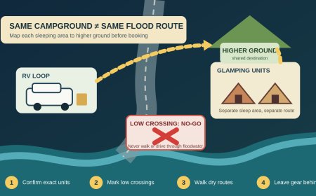
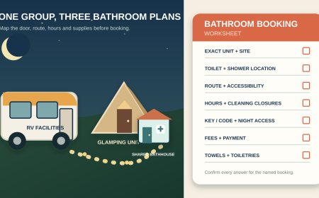
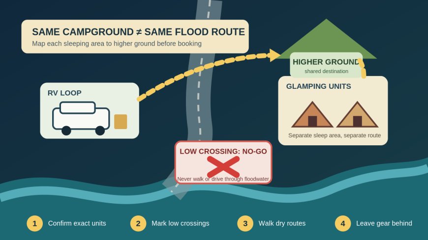
The shortest route is useless if water can cut it off. Original RVCamping.info diagram.
Book exact units, not a property-wide reassurance
"Creekside," "river view" and "level tent pad" describe amenities, not drainage. Ask about the numbered RV site and named cabin, yurt or furnished tent in your reservation. A general answer from the office may describe the entrance or the highest loop rather than the low road between the two parts of your group.
The National Park Service tells campers to consider flash flooding among the hazards around a campsite and recommends a tent location on level ground that is not a low place.[3] A current federal listing for Peppersauce Campground gives a concrete example: its creek is usually dry, yet the listing warns that rain can bring flash flooding there.[4] Dry on arrival does not mean outside the water path.
Ask staff to answer these questions on a map or in writing:
- Which exact RV site and glamping unit will our group occupy?
- Is either unit beside a creek, wash, drainage swale, steep slope or low road?
- Which bridges, culverts, dips or unpaved sections lie between the units and the exit?
- Where does the property direct guests during rising water or a flash-flood warning?
- Can every traveler reach that place by an accessible route that avoids low crossings?
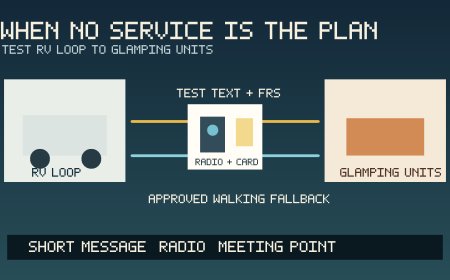
- How are overnight guests notified if cellular service, power or the office is unavailable?
- Who can authorize a move to another unit, and when does that decision need to be made?
Do not ask staff to promise that flooding cannot happen. Ask for known routes, local procedures, recent access trouble and the action they expect guests to take. Save the reply with the reservation.
Draw one map for both lodging areas
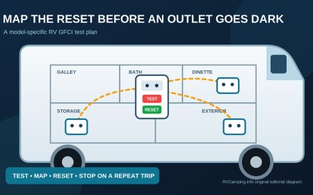
Put the RV site, every glamping unit, office, campground exit and designated higher-ground location on one page. Then mark water and terrain features between them. A neat dashed line between the RV and cabin is not enough; the line must follow a route the property permits and expects to remain usable.
Use four labels:
- sleep: each exact overnight location;
- go: the property's named higher-ground or evacuation location;
- no-go: creek banks, washes, low bridges, drainage channels and roads staff identifies as flood-prone;
- decision point: the place where the group must turn back rather than test water depth.
The National Weather Service advises campers to identify the fastest way to higher ground and ask whether nearby roads are likely to flood and block evacuation.[2] That makes route separation important. If the RV loop and glamping row approach higher ground from opposite sides, do not plan a reunion at the low point. Each lodging cluster should use its safe route and meet only at the named destination.
Walk the approved routes in daylight after arrival. A night check should not be the first time someone discovers a locked gate, steep step, washed-out edge or missing sign.
Know what a watch changes and what a warning ends
A National Weather Service Flood Watch means conditions are favorable for flooding; flooding is possible, not certain. A Flood Warning means flooding is imminent or happening. A Flash Flood Warning means flash flooding is imminent or occurring, and people in a flood-prone area should move immediately to higher ground.[5]
Turn those terms into group actions before the trip:
| Trigger | Group action |
|---|---|
| Heavy rain in the forecast | Recheck campground alerts, unit assignment, road status and cancellation terms before departure. |
| Flood Watch covering the campground | Keep everyone reachable, move vehicles only if staff directs and the route is dry, pack essential medication and documents, and suspend activities that cross low areas. |
| Water beginning to rise, staff evacuation order, Flood Warning or Flash Flood Warning affecting the property | Use the approved route to higher ground immediately. Leave gear. Do not wait for the rest of the group at a creek, bridge or low road. |
| Water over any route | Treat the route as closed. Turn around and use the pre-identified alternative or call for help from a safe location. |
NWS guidance says to evacuate immediately when water starts to rise and to move to higher ground if camping in a low-lying area.[1] The group's departure trigger can be earlier than an official warning when staff closes a route, a traveler needs more time or the only exit has a history of becoming impassable.
Keep the RV out of the rescue plan
A large vehicle can feel like the obvious tool for collecting everyone. That idea fails if the pickup route crosses the lowest road on the property. NWS warns against driving into flooded roads or around barricades because water can hide a washed-out surface and other hazards.[1]
Set a strict rule: the RV does not shuttle through standing or moving water, probe a flooded road, tow another guest through it or wait on a bridge. Nobody walks from a cabin to the RV through water because the RV looks safer or holds the group's supplies.
If staff says vehicles should move before conditions worsen, do it while the approved route is open and dry. Once water covers the route, leave the vehicle and equipment decision to emergency personnel. Property can be replaced; a person stranded while retrieving it creates a second emergency.
Give each sleeping unit a leave-now kit
Do not store the only rain gear, medications, shoes, flashlight or map in the RV when some travelers sleep in a cabin or tent. Each separate lodging unit needs a small kit that can leave with its occupants:
- sturdy footwear and weather protection;
- flashlight or headlamp for each responsible adult;
- essential medication and necessary medical supplies;
- paper map with the approved route and destination;
- campground and emergency contacts;
- charged phone plus an approved backup battery;
- identification, vehicle keys and any accessibility equipment needed for the route; and
- a written list of the people assigned to that unit.
Keep it reachable without stepping outside into the hazard. This is not an invitation to delay departure while packing. The kit exists so the group can move when the trigger is reached.
NWS camping guidance notes that a campground alarm may depend on electricity and recommends an alternate way to notify campers if power fails.[2] Ask what the property uses. For the group, that may mean weather alerts on more than one phone, a NOAA Weather Radio where reception supports it, staff notification and a scheduled in-person check before conditions deteriorate. Do not depend on one person in the RV hearing an alert for everyone.
Plan for the slowest safe route
A route can be technically open and still fail a traveler who cannot handle loose gravel, darkness, stairs or a steep grade. Ask the person what help and equipment work for them. Then ask the property whether the designated destination and route are usable for that person.
Assign support by sleeping unit rather than assuming the RV occupants can cross the campground to help. Keep mobility equipment, medications and communication aids with the traveler. If the only approved higher-ground route cannot support someone in the group, request a different unit or choose another property.
Children should move with their assigned adult. Pets need a leash or carrier where required, but nobody should return into a closed area for an animal, bag or vehicle. Confirm the property's animal procedure before arrival.
Run a ten-minute arrival check
Before luggage spreads across two parts of the campground:
- Confirm the unit numbers match the written reservation.
- Ask staff whether rain, closures or maintenance changed the approved route.
- Walk each dry route in daylight without entering closed or hazardous areas.
- Locate the higher-ground destination and the after-hours contact.
- Test each lodging unit's alert and communication methods.
- Put one leave-now kit and paper map in each unit.
- Review the trigger table in plain language with the whole group.
Stop the check if water is already rising or staff has issued instructions. Arrival is not the time to conduct a personal drainage inspection in a creek, culvert or wash.
Use this booking worksheet
Property and dates: ____
RV site/loop: ___
Glamping unit/area: _____
| Check | Written answer or map mark |
|---|---|
| Exact sleeping units confirmed | ____ |
| Creek, wash, slope and low-road exposure | ____ |
| Approved route from RV to higher ground | ____ |
| Approved route from glamping unit to higher ground | ____ |
| Low crossing that nobody will use | ____ |
| Accessible route and support assignment | ____ |
| Overnight warning method without cell service or power | ____ |
| Staff and after-hours contacts | ____ |
| Reassignment/cancellation decision time | ____ |
| Leave-now kit owner in each unit | ____ |
Reject or change the booking when the property cannot identify an all-weather destination, the only route requires crossing a known low point, a traveler cannot use the evacuation route, or separate lodging areas would have to move toward each other through the hazard.
The group does not need to predict the weather weeks ahead. It needs a reservation that leaves room to act, exact routes that do not depend on crossing water and a shared rule everyone can remember: higher ground first, gear later.
Sources
What's Your Reaction?