










The 15-minute RV road-conditions check before departure
A practical RV departure routine using state 511 tools, park alerts and route-specific checks for closures, construction, weather and vehicle limits.


A navigation app can show a blue line while missing the detail that matters to an RV: a closed access road, a trailer-specific chain rule, a one-lane work zone, or a park road that bans vehicles over a stated length. The fix is a short source check before the wheels move.
The federal 511 number is available nationwide as a route to current travel information, but states and local agencies decide how their systems work.[1] Treat 511 as a family of official state services, not one national map with identical coverage.
First, write down the rig that is traveling
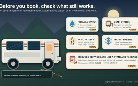
Keep one note with the motorhome or combination's measured height, overall travel length, width, loaded weight, number of axles, and whether a trailer or towed vehicle is attached. Include rooftop air conditioners and antennas in the height. Use exact vehicle labels and manuals for ratings; do not estimate a safe limit from the model name.
That note turns a vague alert into a decision. A 22-foot restriction may clear a camper van and reject a longer motorhome. North Cascades National Park, for example, bars RVs, large trailers and anything longer than 22 feet from Cascade River Road.[4] The same park page directs visitors to Washington State's real-time map for State Route 20 closures, showing why the park page and state road system need to be checked together.[4]
The 15-minute check
Minute 0 to 4: trace every highway and access road
Open the official 511 or transportation-department map for each state on the day's route.[1] Search by highway number, direction and milepost where the tool permits it. Turn on layers for full closures, lane closures, incidents, cameras, weather stations, chain controls and message signs.[2]
Caltrans says QuickMap combines speed, construction and maintenance closures, incidents, message signs, camera snapshots and active chain controls.[2] Those layers are separate for a reason. A route that appears open may still have a restriction that changes whether a tall, heavy or trailer-towing vehicle should use it.
Do not stop at the overview map. Open each event card and read its direction, mileposts, start and end times, lane status and vehicle wording. Caltrans also notes that its main QuickMap display shows active lane closures while planned closures are available through a separate planned-closures link.[2] For tomorrow morning's departure, the planned list can matter more than what is active tonight.
Minute 4 to 8: inspect the final miles
Open the campground, park, forest or local road page. Search for the named entrance road and the last junction, not only the destination name. Look for length limits, seasonal gates, gravel or washboard warnings, bridge limits, construction schedules and statements that trailers are prohibited or not recommended.
A state highway may be open while the final campground road is not suitable for the rig.[4] Conversely, a park page may say an internal road is open while warning that the connecting state highway can close.[4] Record both checks and their update times.
Minute 8 to 11: read weather restrictions as vehicle rules
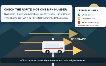
Look for chain controls, high-profile-vehicle warnings, trailer restrictions and road-weather cameras. Do not convert an alert into your own universal wind or snow threshold. The agency's wording, the rig's actual configuration and the driver's judgment control the decision.
In California, the QuickMap FAQ lists special chain-control messages for vehicles pulling trailers and for truck-trailer combinations.[2] That is a useful reminder to open the legend instead of assuming a passenger-car symbol applies unchanged to an RV combination.
Minute 11 to 13: build one legal alternate
Choose an alternate that has been checked for the same dimensions and restrictions. A detour suggested for cars can include a low bridge, narrow local road or a turn that a long combination cannot make comfortably. If no verified alternate exists, the backup is a safe place to hold, not an improvised shortcut.
Write down the last safe fuel stop, rest area or commercial parking option before the decision point. Save the relevant state phone number because data coverage often disappears exactly where a mountain or canyon route becomes complicated.
Minute 13 to 15: save evidence offline
Take screenshots or save the event text with its update time. Record the highway, direction, mileposts and agency contact. Oregon says its telephone 511 information matches what appears on TripCheck, and it supplies a toll-free number for carriers that do not support dialing 511.[3] A phone route is useful when the map will not load, but recheck conditions close to departure because closures can change.[1][3]
Tell another traveler which route was checked and where the hold point is. The driver should not be trying to read map layers or event text while moving.
A simple go, hold or reroute decision
Use go only when the primary and final-access roads are open for the actual rig, the agency restrictions are understood, and the driver is comfortable with the conditions.
Use hold when the restriction is unclear, the event is changing, the alternate has not been checked, or the driver would reach a closure without a safe place to turn around. Call the listed road or park office if the wording does not identify whether an RV or trailer is included.
Use reroute only after checking the substitute road with the same process. Add fuel range, daylight, grade and a safe turnaround to the decision; a route that is technically open can still be a poor operational choice for a particular rig.
What 511 cannot decide for you
A 511 map reports agency data. It does not know the measured height of an air conditioner, the current loaded weight, the condition of the tires, the driver's mountain-road experience, or whether the campground entrance can accept the combination. It also may not show a new incident immediately.
The short check works because it joins three records: the rig note, the official state road report, and the destination's access page. Save all three, then check again before entering the final remote segment.
Sources
- FHWA: About 511 (retrieved September 15, 2026).
- Caltrans QuickMap frequently asked questions (retrieved September 15, 2026).
- Oregon TripCheck 511 (retrieved September 15, 2026).
- North Cascades National Park road conditions (retrieved September 15, 2026).
What's Your Reaction?