











Before you take an RV onto BLM or Forest Service land, run this rules check
A repeatable pre-trip check for local BLM and Forest Service stay limits, closures, fire orders, waste rules and legal RV access.

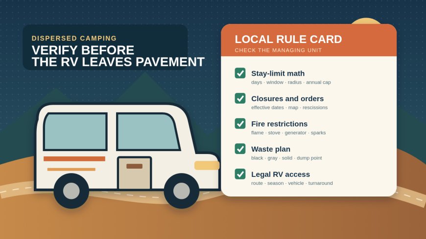
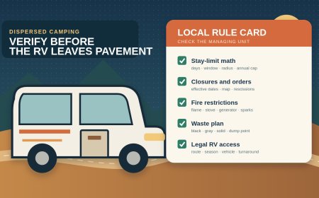
Do not rely on a generic "14-day dispersed-camping rule." Before taking an RV onto Bureau of Land Management or U.S. Forest Service land, identify the managing field office or ranger district, read that unit's current alerts and signed orders, check the legal motorized-access map, and confirm fire and waste requirements. Repeat the check shortly before departure.
The number people remember is only a starting point. The BLM describes 14 days in 28 as a general pattern, then warns that states and individual field offices can set different limits.[1] Local Forest Service orders can count consecutive days, calendar-year days, cumulative days, distance from a road, or distance from the previous camp. That wording decides whether a stay is legal.
Why the agency name is not enough
"BLM land" and "national forest" describe huge systems, not one camping rulebook. A campsite can also sit near a field-office, ranger-district, state, county, tribal or private boundary. A pin in a camping app does not establish which parcel contains the turnout, much less which office issued the controlling order.
Start with the exact camp coordinate and the road used to reach it. Match both to the agency's administrative map. Write down:
- managing agency;
- BLM field office or Forest Service ranger district;
- forest, monument or special-area name;
- road number, if one exists;
- nearest named junction; and
- office phone number.
If the boundary is uncertain, call the office with the coordinate. Ask the employee to identify the managing unit before asking about camping. This prevents a correct answer for the wrong side of a boundary.
A repeatable six-part verification method
Use one note for the trip. Add the URL, order number, effective dates and the time checked beside every answer. A screenshot is useful, but the signed order and its map control when a summary page and an order differ.
1. Translate the stay limit into a sentence
Record more than the maximum number of nights. Copy the rule into these fields:
| Field | What to record |
|---|---|
| Maximum stay | Number of nights or days |
| Counting window | Consecutive stay, 28 days, 30 days, calendar year or 12 months |
| Area being counted | Same site, stated radius, ranger district, forest or another boundary |
| Required move | Distance and whether leaving federal land qualifies |
| Reset condition | Time before returning, if stated |
| Other cap | Annual or cumulative limit |
| Validity | Order number, start date, expiration date and any rescission |
The differences are not academic. An Angeles National Forest order in force through December 15, 2026 limits dispersed camping to seven consecutive days, applies a shorter three-day limit near certain public roads, and sets a 21-day total for the calendar year.[4] A Mendocino National Forest order uses 14 days in a 30-day span, adds a 28-day cap across 12 months, and measures location and developed-site separation by a one-mile radius.[5]
Those two current Forest Service examples are enough to retire the shortcut that every national forest grants the same 14-day stay. They also show why "we moved to the next pullout" may not reset anything.
2. Check closures separately from camping rules
Open the local unit's Alerts, Notices, Closures or Forest Orders page. Search the destination name, road number and nearby drainage or landmark. For each result, inspect:
- the signed order, not only the headline;
- the closure map and written boundary;
- roads and trails named in the order;
- start and end dates;
- whether the order remains effective until rescinded; and
- later amendments, partial rescissions or replacements.
A closure can leave the highway open while closing the land on both sides. It can also close a road but leave other parts of the management unit open. Treat the map as part of the order.
This check is time-sensitive. Run it while planning, again 48 to 72 hours before departure, and once more before leaving pavement or reliable service. If the page lists an emergency order without a clear map, call.
3. Read the actual fire order
A red banner that says "Stage 1" or "Stage 2" is not enough. Open the order for the district that contains the camp. BLM Utah, for example, organizes its fire information by management district and links fire restrictions and prevention orders from the state page.[2]
Record how the order treats:
- wood and charcoal fires;
- propane stoves and fire pits;
- smoking;
- generators and internal-combustion equipment;
- spark arresters;
- welding or grinding; and
- parking or driving over dry vegetation.
Do not convert a rule for one district into a statewide rule. Do not assume a propane device is exempt because it has an off switch. The order may restrict the device, require a cleared area, or allow use only in a developed site. Also check whether a state, county or tribal restriction covers the route or adjacent parcel.
4. Prove that the RV can legally reach the site
For a national forest, obtain the current Motor Vehicle Use Map for the correct district. The Forest Service describes the MVUM as the official record of routes open to motorized travel; it can specify vehicle class, season and any limited off-route allowance for dispersed camping.[6]
An MVUM answers "may I drive here?" It does not promise that a road is maintained, passable or suitable for a motorhome. Forest Service guidance for the Pacific Southwest warns that some dispersed-camping roads are steep, rough or narrow enough to be unsafe for larger RVs and advises checking with the local office.[8]
Use two access tests:
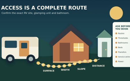
- Legal access: Is the route shown for the RV's vehicle class on the travel-management map? Is it open on the planned date? Does the map authorize leaving the route to reach an existing campsite, and by how much?
- Physical access: Is there a gate, washout, snow, mud, low branch, weak bridge, tight switchback or missing turnaround? Can the entire combination enter and leave without backing a long distance?
Give the office the RV's measured height, width, total travel length, weight where relevant, drive type and whether it tows a car or trailer. Ask about the road by number and the last junction. "Can an RV make it?" is too vague.
For BLM land, use the local travel-management map or route inventory named by the field office. The BLM's national camping page says vehicles generally belong on designated roads and trails, but it also tells visitors to verify local rules.[1] A recommendation such as camping near a route is not permission to create a track.
5. Settle waste rules before filling the tanks
Separate four waste streams in the trip note: trash, black water, gray water and solid human waste outside the RV. Then find the rule for the exact area.
The BLM says disposal methods change with terrain and local requirements. Its Utah guidance says some desert, alpine and canyon settings require visitors to pack out solid waste, while a cathole may be accepted elsewhere; it also says bagged waste must not be put into BLM vault toilets.[3] That means a shovel is not a universal compliance plan.
For an RV, the conservative operational plan is simple: arrive with enough holding capacity, keep black and gray water in their tanks, and use a legal dump station. Caribou-Targhee National Forest specifically says RV gray-water tanks must go to a designated dump station rather than being emptied at a dispersed site.[7] Other units may phrase their rules differently, which is another reason to check locally instead of applying one forest's wording nationwide.
Ask these questions if the page is unclear:
- Is a self-contained toilet required at this site?
- Must all solid human waste be packed out?
- Are engineered waste bags acceptable?
- Where is the nearest approved disposal or dump point?
- May any wastewater be discharged on site?
- Are food scraps, ash or pet waste covered by a separate order?
Do not use a vault toilet as an RV dump. Do not leave a waste bag beside a full bin.
6. Make the final call with the office
Call when an order is missing, its map is unreadable, two pages conflict, the access route is questionable, or the trip overlaps an expiration date. Use a short script:
I plan to camp at latitude ___, longitude ___, reached by Road ___. My RV is ___ feet long, ___ feet high, and I am towing ___. Which office manages that coordinate? What stay limit and counting area apply? Are there current closures or fire orders? Is that road legal for my vehicle on my dates? Is a portable toilet or waste pack-out required?
Record the date, time, office and answer. A phone call helps resolve ambiguity, but it does not replace a later emergency-closure check.
The two-minute departure-day check
Before moving the RV, confirm five lines in the trip note:
- Stay: planned nights fit both the local window and any annual cap.
- Closure: no new order covers the camp or access road.
- Fire: the current district order permits the equipment you packed.
- Waste: holding capacity and legal disposal plan cover the stay.
- Access: the route is legal today and the office or current report shows no condition that strands the rig.
Save the orders, maps and office number offline. Mark a last safe turnaround and a fallback campsite outside the affected area. If any line is unknown, hold on pavement and resolve it. A dispersed site is not worth testing an unsigned road, a shrinking fire perimeter or a rule remembered from another state.
Sources
- Bureau of Land Management: Camping on Public Lands (retrieved September 16, 2026).
- Bureau of Land Management: Utah Fire Restrictions (retrieved September 16, 2026).
- Bureau of Land Management: When Nature Calls — Properly Dispose of Human Waste (retrieved September 16, 2026).
- Angeles National Forest: dispersed-camping stay restrictions through Dec. 15, 2026 (retrieved September 16, 2026).
- Mendocino National Forest: dispersed camping stay limits (retrieved September 16, 2026).
- Deschutes National Forest: Motor Vehicle Use Maps (retrieved September 16, 2026).
- Caribou-Targhee National Forest: Dispersed Camping (retrieved September 16, 2026).
- Pacific Southwest Region: Dispersed Camping (retrieved September 16, 2026).
What's Your Reaction?