






Seasonal road gates and RV routes: why a map app cannot prove the road is open
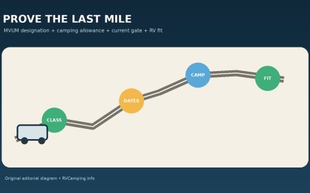
Verify seasonal road gates with the operating agency, segment-level status, on-scene controls, and an RV fit check instead of trusting a map app route line.

Seasonal road gates and RV routes: why a map app cannot prove the road is open
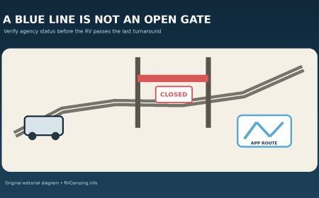
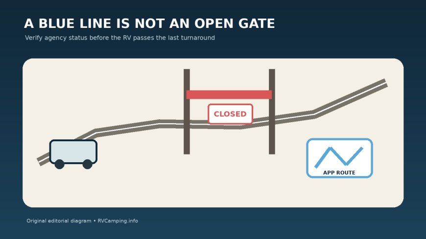
A navigation app can draw a blue line through a locked gate. It can also route an RV to the wrong park entrance, across a road that opened last year on the same date, or along a forest road whose lower segment is open while the upper segment is closed. The app has solved a geometry problem. It has not verified access.
Mount Rainier National Park warns that GPS may lead visitors to the wrong entrance or toward closed gates and that rerouting can take hours.[3] The problem gets harder with an RV because turning around may require more room than the closure approach provides. Treat every seasonal gate as a decision point that must be cleared by the agency responsible for the exact road, then confirmed again before the rig passes its last safe turnaround.
This guide is about ordinary seasonal and condition-based access gates on park, forest, county, and similar recreation roads. It is not a mountain-pass opening-date guide or a general 511 check. The job here is narrower: prove that each gate on the last-mile route is open to public vehicles now, under the rules that apply to the RV, without relying on a map app's route line.
A route line and an open gate are different data
Consumer map apps are useful for estimating distance and locating junctions. Their road network may remain visible all year because the pavement or roadbed still exists. That does not show whether a land manager has locked a seasonal gate, extended a wet-weather closure, closed a damaged segment, or limited the road to nonmotorized use.
Official agencies separate these questions. Sierra National Forest publishes a current-conditions table with road status, seasonal gate dates, and comments. It also warns that opening and closing dates can change without notice because of weather and safety factors, and it tells travelers who find a gate closed after an MVUM opening date to contact the forest roads manager.[1] Coconino National Forest says its list covers only main, frequently used roads, conditions can change sharply with elevation, and visitors must obey on-the-ground closures and barricades.[2]
That leads to a simple evidence order:
- current official status or closure order for the exact segment;
- current notice from the agency that operates the gate;
- on-the-ground gate, sign, barricade, or staff direction;
- map-app routing only as a navigation aid.
A screenshot of an app route belongs at the bottom of the stack.
Identify every gate before checking status
Start with the destination and work backward to the last all-season public road. Mark each point where access can be interrupted:
- park entrance gate;
- winter or seasonal gate;
- campground or recreation-site gate;
- Forest Service road gate;
- county snow gate;
- private easement or concession gate;
- junction where a temporary closure begins.
For each one, record the road number, gate name if published, nearest junction, managing agency, and the final legal turnaround before it. Do not label a whole 18-mile access road "open" when the evidence covers only the first six miles.
White Mountain National Forest's status page illustrates why ownership matters. It notes that the Forest Service maintains only National Forest System roads and that many roads near or within the forest are operated by local, state, or other federal agencies.[4] A forest webpage may therefore point you to a town or state DOT for one segment. Check the owner of every link in the route, not merely the owner of the destination.
Use a gate ledger:
| Gate or segment | Operating agency | Published season | Current status and timestamp | RV restriction | Last turnaround |
|---|---|---|---|---|---|
| Main approach | State or county | Year-round or seasonal | Agency road page | Size, weight, chains | Named junction |
| Forest access road | Forest or county | Exact date range | Forest status/order | Surface and vehicle class | Pullout before gate |
| Recreation-site spur | Forest, park, or concessioner | Facility schedule | Site alert or call | Combination length | Entrance area |
| Destination gate | Site operator | Hours or season | Same-day confirmation | Check-in rule | Do not block gate |
Leave the status unknown until a current source covers the exact segment. "The app offers the route" is not a status.
Published dates are research triggers, not guarantees
A seasonal table tells you when to begin checking. It may not promise that a gate opens on that date. Weather, snowpack, saturated roadbeds, storm damage, fire, construction, staffing, or resource protection can delay an opening or force an early closure.
Sierra National Forest explicitly labels its dates as subject to change and condition-based.[1] White Mountain National Forest explains that seasonal closures may protect a roadbed or reflect snow, ice, and impassable conditions, while damaging weather can cause additional temporary closures.[4] A date from last year is even weaker. It is useful for choosing a likely travel month, not for committing the RV to the approach.
Separate three pieces of information:
- scheduled window: the usual or published open season;
- current administrative status: open, closed, limited, or unknown on the official page or order;
- physical condition: passable for this RV today.
All three must support the trip. A gate may be administratively open while mud or a washout makes the road unsuitable. A dry, smooth road behind a locked seasonal gate is still closed.
Read status notes down to the segment
Status tables often contain the detail an app discards. A route may be open to a second gate, open only from one end, closed above a reservoir, or open while an interior bridge keeps it from being a through route. Coconino tells visitors that not all forest roads appear in its list and to call the appropriate ranger station with questions.[2] White Mountain's page includes examples where one end of a road remains closed after storm damage while another portion is open.[4]
For every status entry, capture:
- the road number and name;
- beginning and ending points;
- direction, if it matters;
- update date and time;
- whether "open" means public motor vehicles or another use;
- vehicle or trailer restrictions;
- the condition note;
- the source URL and agency contact.
Do not merge two roads because the app uses one continuous label. Do not assume "recreation area open" means its access road, campground gate, water, or dump station is open. Verify each dependency.
Run an RV fit check after the gate check
An open gate does not certify an RV route. Sierra's status table can pair an open status with cautions such as rough road conditions or trailers not advised.[1] Coconino warns that conditions can change drastically with elevation and that travelers may encounter deep snow and four-wheel-drive conditions on the same road.[2]
Once the access status passes, compare the road with the loaded rig:
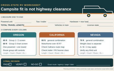
- total connected length, not just trailer or motorhome body length;
- height, width, weight, rear overhang, and turning circle;
- one-way sections and time controls;
- posted trailer or vehicle-length prohibitions;
- bridge and culvert limits;
- road width, passing places, switchbacks, grades, and drop-offs;
- surface, ruts, mud, snow, ice, washouts, and water crossings;
- overhead limbs and rock projections;
- legal parking and turnaround space at the destination.
Mount Rainier advises checking its road-status page and alerts because unexpected closures can occur, and it notes that many park roads are narrow and winding.[3] That official status check does not replace the rig-fit check. It comes before it.
If the agency says "high clearance," "four-wheel drive recommended," "trailers not advised," or gives a length limit, take the wording literally. An app's estimated travel time does not account for a long rear overhang dragging through a dip or a trailer that cannot make the turnaround.
Check three times and save what you checked
Use a three-stage schedule:
Planning check
Seven to fourteen days before travel, identify all agencies and gates. Save the official seasonal schedule, route restrictions, alerts page, phone numbers, and a checked alternate. This is when to move a reservation or choose a different campsite.
Commit check
The evening before departure, refresh each official status. Note its last-updated time. Check weather and recent precipitation for unpaved roads. If the page is stale, omits the road, or conflicts with another agency, call during office hours. Record who answered and what segment the answer covered.
Last-turnaround check
Immediately before leaving reliable service, refresh the status again while parked. At the final safe turnaround, look for a changed sign, barricade, or gate position. A live webpage does not grant permission to pass a closed gate. On-scene controls win.
Download the official pages or take timestamped screenshots for offline reference. Also save the forest or park map. Offline storage prevents a weak signal from turning a known route into guesswork, but the saved status still represents the time it was captured.
If the gate is closed, stop without improvising
Do not drive around a gate, move a barrier, squeeze past a berm, or follow tire tracks into the ditch. Do not block the gate while deciding what to do; emergency, fire, maintenance, and administrative access may depend on it. Back up only if a spotter can do so safely, and return to the last verified turnaround.
Parking outside a gate is a separate decision. Confirm that parking is allowed, the RV fits fully outside the traveled lane, no sign or order prohibits overnight use, and the vehicle will not block the gate or snow-removal area. A closed road does not turn its apron into a campsite.
Use the alternate already checked. Do not accept the app's instant detour until that route passes the same agency, gate, restriction, and rig-fit tests. A detour that rejoins above the locked gate or crosses a private road is not a solution.
Resolve conflicting information conservatively
Conflicts happen. A schedule may show the planned opening date, a status table may still say closed, and a map app may route straight through. Treat that as closed until the operating agency resolves it.
Call with details rather than asking whether "the road to camp" is open:
Is Forest Road 123 open today to public highway-legal vehicles from County Road 8 to the Pine Campground gate? I am driving a 31-foot motorhome. Is the seasonal gate physically open, are there any length or trailer restrictions, and is there a safe turnaround before the closure if conditions change?
Record the agency, office, time, and answer. A phone call can clarify a stale page, but it does not authorize passing a gate or sign that is closed when you arrive. Stop and call again.
Build a gate-proof route card
The finished route card should fit on one page:
- destination and travel window;
- RV dimensions and connected configuration;
- every road owner and segment;
- every gate and its official name or location;
- scheduled dates;
- current status, source, and timestamp;
- road-condition and vehicle-restriction notes;
- last legal turnaround before each gate;
- agency phone numbers;
- separately verified alternate;
- a departure cutoff that prevents a late arrival.
Write the decision at the bottom: GO only if every required gate is confirmed open by its operating agency, no on-scene control contradicts that status, and every open segment fits the loaded RV; otherwise turn around at the recorded point and use the verified alternate.
The map app still has a job. Let it announce turns on a route you have already proved. Do not ask it to decide whether a seasonal gate is open, because a line on a screen cannot answer that question.
Sources
What's Your Reaction?