




Black Rock or Cottonwood? Choose the Joshua Tree RV base that fits your route
Choose Black Rock or Cottonwood by arrival corridor, next-day route, exact rig fit and slide-out clearance—not by a nearly identical amenity list.

Black Rock or Cottonwood? Choose the Joshua Tree RV base that fits your route
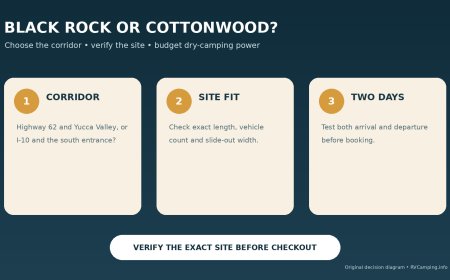
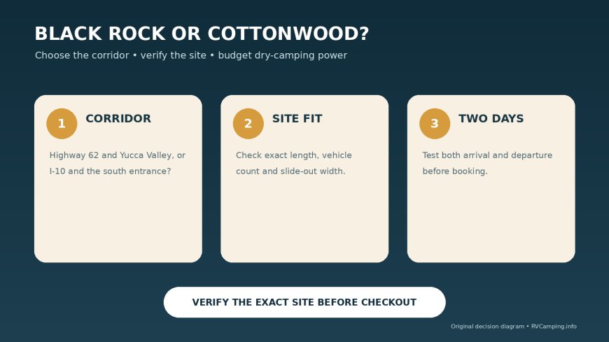
Black Rock and Cottonwood look almost tied on an amenity list. Both are reservation campgrounds with drinking water, flush toilets and a dump station, and neither provides campsite hookups.[1][3][5] For an RV traveler, the useful difference is route architecture: Black Rock supports a Highway 62 and Yucca Valley trip, while Cottonwood supports an Interstate 10 arrival and a south-to-north park traverse.
Short answer: Choose Black Rock when the trip begins or ends around Yucca Valley, town resupply matters, and an exact site fits a rig no longer than the campground's 35-foot maximum. Choose Cottonwood when I-10 is the logical approach, the southern park is part of the itinerary, and the exact site has enough length and width for the RV. Cottonwood's narrow parking areas make slide-out clearance a separate decision from length.[2][3][5]
This is a route-first comparison, not a claim that one desert setting is universally better.
The route decision in one table
| Planning question | Black Rock | Cottonwood |
|---|---|---|
| Natural arrival corridor | Highway 62 through Yucca Valley | I-10, exit 168 |
| Useful town relationship | Yucca Valley services are five miles away | Better for a southern arrival or departure |
| Campsite hookups | None | None |
| Shared RV service | Potable water and dump station | Potable water and dump station |
| Published RV headline | 35-foot campground maximum; not all sites fit long RVs | Some family sites accept a combined RV length up to 35 feet |
| Width warning | Check the exact listing | Most sites cannot accommodate slide-outs |
| Best itinerary shape | Northern base with town errands | Southern base or one-way park traverse |
The two campgrounds solve the same tank problem but different driving problems. Pick the travel corridor first, then verify the site.
Black Rock: build the trip around Highway 62
Recreation.gov places Black Rock on the park's northern perimeter and directs arrivals through Yucca Valley, turning south from Route 62 onto Joshua Lane. It lists showers, laundry and other town amenities five miles away.[3] That makes Black Rock the practical base when groceries, laundry, fuel or a Highway 62 continuation are part of the plan.
NPS publishes a maximum RV length of 35 feet and immediately warns that not every site can handle a long RV.[2] The correct reading is not “all 35-foot RVs fit Black Rock.” It is “35 feet is the campground ceiling, and the individual listing still controls.”
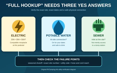
Black Rock has 99 individual sites, flush toilets, drinking water and a dump station, but no hookups.[1][3] The water and dump facilities support tank servicing; they do not provide a water or sewer connection at the pad. An electrical plan is still required for every night.
Choose Black Rock when:
- Highway 62 is already on the travel day;
- Yucca Valley resupply reduces a separate errand;
- the exact site accepts the measured RV and vehicle count;
- the stay can operate without campsite hookups;
- returning to the northern corridor fits the next day's route.
The last item is easy to overlook. A northern base is efficient when the trip continues north or west. It can create avoidable backtracking when the next fixed destination is east on I-10.
Cottonwood: make I-10 part of the campground plan
Recreation.gov directs Cottonwood arrivals from I-10 at exit 168, the Mecca/Twentynine Palms exit, and warns that the park headquarters address is not the campground's physical address.[5] Cottonwood therefore makes sense when the RV is already moving along I-10 or when the trip is designed to enter from the south and continue through the park.
Cottonwood has 62 sites, drinking water, flush toilets and a nearby dump station, but no campsite hookups.[1][5] The service category is functionally similar to Black Rock for tanks. It does not solve the electrical side of dry camping.
The decisive caveat is width. Recreation.gov says most Cottonwood campsites cannot accommodate RV slide-outs because the parking areas are narrow.[5] A site can meet the length filter and still fail the living-space plan. Verify slide deployment, traffic-side clearance and whether every wheel and deployed component can remain within the legal site footprint.
NPS says a limited subset of family sites accepts a total RV setup as long as 35 feet when the towed vehicle is included in that measurement.[4] “Some” and “combined” do the work in that guidance. Do not apply 35 feet to every site, and do not compare that number only with the motorhome body while ignoring a towed car.
Choose Cottonwood when:
- I-10 is the natural arrival or departure route;
- the southern side of Joshua Tree is part of the plan;
- the exact site accepts the total measured setup;
- slide-outs are unnecessary or the listing confirms enough width;
- the RV can dry camp without a pedestal.
Tank service is a tie; power is not provided at either site
NPS locates Black Rock's RV dump near site 6; Cottonwood's is along the segment linking its visitor center and campground. Water-fill points are available in those two service areas as well.[1] The facility page gives the current dump fee as $5, paid at an entrance station.[1]
That creates a useful arrival routine at either campground:
- Confirm that the station is operating before relying on it.
- Fill or dump without blocking circulation.
- Move to the reserved site with enough fresh-water and waste capacity for the stay.
- Do not interpret shared service as permission to remain connected.
Both facility records state that individual sites lack electric, water and sewer hookups.[3][5] If continuous shore power is essential, neither campground satisfies the requirement. The correct comparison is then an outside hookup campground versus a day visit, not Black Rock versus Cottonwood.
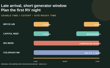
NPS limits generator use to 7–9 a.m., noon–2 p.m. and 5–7 p.m.[1] Those windows may support planned charging, but they do not provide continuous cooling. Build the electrical budget from the RV's actual loads and weather needs before reserving.
Run the exact-site fit test
For Black Rock, start with the 35-foot campground maximum, then narrow to the individual site.[2] For Cottonwood, start with the site's combined-length language and the slide-out warning.[4][5]
Record these fields before checkout:
- motorhome or trailer body length;
- full tow-vehicle and trailer combination, or motorhome and towed-car plan;
- total height and any listing clearance note;
- number of vehicles allowed;
- back-in, pull-through or parallel parking form;
- grade and surface;
- slide-out and awning deployment width;
- generator need and allowed operating windows.
NPS is explicit that an RV slightly longer than a campsite parking length does not fit and should be assigned to a different site. It warns that an RV extending into the road can be struck or cause a crash.[1] Treat the listed dimension as a boundary, not a negotiation margin.
Use a two-day route test
A campground can look ideal for the arrival day and waste time on departure. Test both ends of the stay.
Black Rock route test
Write down the final stop before camp and the first stop after camp. Black Rock works best when both connect naturally to Highway 62 or Yucca Valley. Add any town errands to the same travel segment rather than making a separate resupply run.
Cottonwood route test
Cottonwood works best when at least one side of the stay connects naturally to I-10 and the other uses the park road intentionally. Entering from I-10 only to return immediately to I-10 may still work for a one-night stop, but it should be a conscious route choice rather than an assumption that the two campgrounds are interchangeable.
Neither framework promises a particular drive time. Traffic, road conditions and closures change. The decision is about avoiding obvious directional backtracking before live navigation is consulted.
Reservation and departure checks
NPS requires reservations at both Black Rock and Cottonwood and directs bookings to Recreation.gov.[1] Before travel:
- Reopen the exact campsite record and confirm the equipment fields.
- Save the confirmation and campground directions offline.
- Check park alerts and road conditions.
- Verify dump and fill availability rather than assuming the amenity is operating.
- Recalculate the power budget against the official generator windows.[1]
Use the campground name, not the park headquarters address, for routing to Cottonwood.[5] For Black Rock, follow the official Yucca Valley and Joshua Lane directions rather than assuming any road shown on a general park map is an RV through-route.[3]
Bottom line
Black Rock is the better route choice for a Highway 62 trip that benefits from Yucca Valley services. Cottonwood is the better route choice for an I-10 approach, a southern-park itinerary or a deliberate one-way traverse. Both offer shared water and dump service, and neither offers campsite hookups.[1][3][5]
The physical reservation remains site-specific. At Black Rock, a 35-foot campground maximum does not make every site a 35-foot site. At Cottonwood, a published combined-length allowance does not resolve the warning that most pads cannot take slide-outs.[2][4][5] Choose the corridor, then prove the site.
Editorial note: This research-based comparison uses official NPS and Recreation.gov pages archived October 21, 2026. It does not claim a firsthand drive, campsite inspection, current road check or vacancy check.
Sources
What's Your Reaction?