







Garmin RV 795 review: useful RV routing, not a clearance guarantee
The Garmin RV 795 adds offline maps and RV-aware routing, but it cannot guarantee clearances. A research-based buying and setup guide.

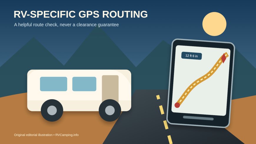
Summary: The Garmin RV 795 is a good fit for frequent RV travelers who want a dedicated seven-inch navigator with offline maps and routes shaped around rig dimensions. Skip it if you expect flawless low-clearance protection or if a phone app already covers your occasional trips. The main tradeoff is dependable, RV-aware navigation hardware versus a route database that still needs human checking.
This is a research-based review. RVCamping.info did not buy, drive with, or physically test this unit.
The exact product reviewed is the Garmin RV 795, Garmin part number 010-02747-00, sold on Amazon under ASIN B09ZJXYL6W. It is the camera-free 795, not the RVcam 795. Garmin still lists this model for sale with a seven-inch display and no built-in dash camera.[1]
As an Amazon Associate, RVCamping.info earns from qualifying purchases. If you buy through an Amazon link in this article, we may earn a commission at no additional cost to you.
Check the Garmin RV 795 (ASIN B09ZJXYL6W) on Amazon.[4]
Verdict
Buy the RV 795 if you travel often, drive a tall or heavy rig, and want a navigation screen that does not surrender its basic maps when cellular service disappears. You can save profiles for a motorhome, a motorhome with a trailer, a travel trailer, or a fifth wheel. Garmin uses the active profile's dimensions, weight, and other entered characteristics when it recommends a route.[1][2]
Skip it if most trips are familiar weekend runs, you dislike maintaining another device, or you want navigation to certify every bridge, road, and campground entrance. Garmin says gaps in its map data can stop the device from applying every saved dimension or displaying every warning. Road signs and actual conditions outrank the screen.[2]
The central tradeoff is not phone versus satellite reception. The RV 795 stores its road maps on the device, but its live traffic, weather, road-condition information, and several connected services depend on a paired phone running Garmin Drive.[1][2] It gives you a stronger offline baseline than a phone-only workflow, then borrows the phone for live data.
The compatibility boundary
The North American RV 795 comes with street-map coverage for the United States, Mexico, Canada, Puerto Rico, the U.S. Virgin Islands, the Cayman Islands, and the Bahamas.[1] Buyers traveling elsewhere should not assume that the U.S. part number includes the maps, regional data, or features they need.
The unit supports several RV profiles, but the profile is only as good as the numbers entered. Use the rig's true travel configuration: overall height to the highest fixed item, width including mirrors where relevant, total length with the towed vehicle or trailer, and current weight limits. Recheck the active profile whenever the navigator moves between a tow vehicle, motorhome, and car. The car profile calculates ordinary automobile routes and disables large-vehicle routing.[2]
Propane settings are another useful but limited layer. The manual says a propane tank can be added to the vehicle profile so the device can avoid known restrictions and warn about areas where tanks may need to be shut off.[2] That does not replace tunnel, ferry, bridge, or local rules. Verify the route through the authority that controls the road.
The RV 795 works with the Garmin BC 50 wireless backup camera, sold separately.[1] That compatibility should not be confused with an included camera or with the RVcam 795's forward-facing dash camera. Amazon's listing for ASIN B09ZJXYL6W identifies the camera-free Garmin RV 795.[4]
What the dedicated navigator does well
It keeps the core map off your phone
Garmin preloads the road maps and lets the device calculate routes without a cellular connection.[1] That matters on mountain roads, in desert country, and near remote public campgrounds where a phone may lose data service. An RV Miles reviewer made the practical distinction: stored maps keep routing available away from cell towers, while a phone connection supplies enhanced information when service returns.[3]
This does not make every offline route current. Garmin tells owners to keep maps and software updated and supports large updates over Wi-Fi or through Garmin Express on a computer.[2] Update before a long trip, while the unit has reliable internet and external power, rather than discovering a multi-hour download on departure morning.
The seven-inch screen leaves the phone free
A separate display can stay on the route while a passenger uses the phone for campground details, calls, or a second map. The 795 also shows lane guidance, upcoming grades, sharp curves, weight restrictions, elevation changes, and configurable trip data when those records are available.[1][2]
Seven inches is the compact end of Garmin's RV line rather than a huge cockpit display. RV Miles found the smaller screen showed fewer trip fields at once than the larger Garmin units; the reviewer could not display both remaining hours and miles simultaneously.[3] That is a sensible compromise for a crowded cab, but buyers who want several data panels visible at once should compare the larger models in person.
Arrival imagery can solve the last half-mile
Campground entrances are often harder than the highway portion of a trip. Garmin includes aerial imagery and a Plan Arrival tool that can show the destination area and help select an entrance.[1][2] Use it before moving, especially when a park shares a road with a residential entrance or has a separate gate for larger rigs.
The imagery still needs interpretation. Tree cover, seasonal gates, new construction, and one-way campground roads may not be obvious or current. Compare the overhead view with the campground's own arrival instructions and call if the entrance is ambiguous.
Where the RV routing can still fail
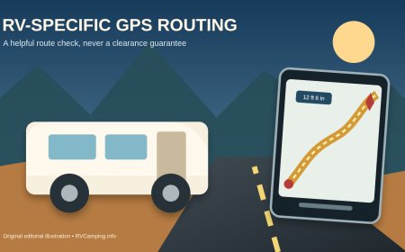
Garmin's warning is unusually plain: the device can miss restrictions even after you enter the rig's dimensions, and some warning icons may never appear because the underlying map data has limits.[2] A driver who treats "custom RV routing" as a clearance guarantee is using the product outside its stated limit.
The safe workflow uses independent checks for the parts of a route where a mistake has serious consequences:
- Confirm the rig's current travel height, length, width, weight, and propane configuration.
- Review the complete route before departure, not only the next turn.
- Check low clearances, seasonal closures, weight-restricted bridges, tunnels, ferries, and steep or unpaved segments against current transportation-agency or road-operator information.
- Read campground arrival instructions and inspect the final approach on a map or aerial image.
- Obey posted signs even when the navigator says to continue.
- Stop somewhere safe before changing the route or studying a questionable turn.
RV Miles reached the same broad conclusion after using Garmin and RV-routing apps: every option can make major mistakes, so a long drive still deserves advance route planning.[3] That independent experience supports Garmin's own limitation rather than overriding it.
Phone connection, traffic, and weather
Pairing through the Garmin Drive app unlocks live traffic, weather, road conditions, hands-free calling, phone notifications, and the ability to send a location from the phone to the navigator.[2] Garmin's product page also lists live fuel prices and connected travel-plaza information.[1]
These features need three things to cooperate: the phone, its data connection, and the Bluetooth/app pairing. Basic stored-map navigation remains the reason to buy the dedicated unit; live services should be treated as a connected bonus. If traffic is essential, confirm the app has reconnected before leaving rather than assuming yesterday's pairing is active.
Smart notifications deserve restraint. Garmin warns drivers not to read or interact with notifications while driving and requires the user to confirm they are a passenger before viewing some content while the device is moving.[2] Disable unneeded notification categories. A seven-inch screen becomes less useful if message popups cover the turn information it was purchased to display.
Power, heat, mounting, and updates
The RV 795 has a rechargeable lithium-ion battery, but the manual treats vehicle power as the normal operating source.[2] Amazon describes battery life as up to one hour.[4] That is enough for route planning away from the mount or a short interruption, not an all-day substitute for the included vehicle power cable.
Garmin lists an operating range of -4°F to 131°F and a narrower charging range of 32°F to 113°F. It also warns against prolonged extreme-temperature storage and direct sunlight.[2] A windshield can exceed the surrounding air temperature. Remove the navigator from the sun and from sight when parked rather than leaving it cooking on the glass.
Mount it where the driver can glance at directions without blocking the road view, gauges, or airbags. Local windshield-mount rules vary, so check the jurisdictions on the trip. Secure the cable so it cannot interfere with pedals or controls. Clean the glass and suction cup before mounting; Garmin's troubleshooting instructions specify rubbing alcohol and a clean, dry cloth when the cup will not hold.[2]
Before the first trip, connect to Wi-Fi, install map and software updates, create the correct vehicle profile, and run several familiar test routes. A familiar route makes odd behavior easier to spot. Save the campground as a destination only after checking that the pin is at the proper vehicle entrance.
RV 795 versus a phone app
A phone app wins on cost and convenience. It may also fit occasional travelers who already plan carefully and do not mind downloading offline maps. The phone loses screen space when calls, alerts, and other apps compete for attention, and some planning features become less useful when data service disappears.
The RV 795 earns its place when it stays mounted, powered, updated, and configured for the actual rig. Its separate display, preloaded maps, RV profiles, road warnings, and arrival view form a coherent travel tool.[1] It is harder to justify if it spends most of the year in a drawer or if the driver will not maintain the maps and verify critical restrictions.
A phone or paper notes still make good backups. Redundancy is useful when a mount falls, a cable fails, an update goes wrong, or the recommended road looks wrong. Two devices using the same stale assumption are not independent verification, so check important constraints at their source.
Bottom line
The Garmin RV 795 is best for frequent travelers who want a dedicated, readable navigator and an RV-aware first pass at route selection. Its offline maps and separate screen are the real advantages. The route warnings, connected traffic, weather, and arrival imagery make trips easier, but none of them turn the unit into a clearance authority.
Buy it for better information and a cleaner cockpit workflow. Keep your measured rig profile current, update the maps, examine the whole route, and let road signs have the last word.
Sources
What's Your Reaction?