








Wildfire Smoke at Your Campsite: A Go, Hold, or Relocate Guide
A practical, conservative framework for combining official fire instructions, campground and route status, AirNow AQI, trends, and smoke outlooks before an RV stay.

Wildfire Smoke at Your Campsite: A Go, Hold, or Relocate Guide
By Romana Category: RV Camping
A green dot at breakfast does not settle a three-day camping decision. Air quality can shift with wind and fire behavior, while a perfectly acceptable AQI reading says nothing about an evacuation order or a closed access road. RV travelers need to make two separate checks: Is the trip operationally safe? and Does the smoke outlook fit the people and activities on this trip?
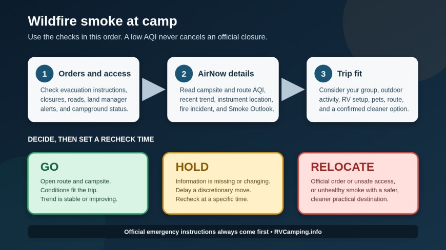
Use this order:
- Check emergency instructions, campground status, road access, and land-manager closures.
- Check the AirNow Fire and Smoke Map at the campsite and along the route.
- Read the current AQI together with its recent trend and any Smoke Outlook.
- Choose go, hold, or relocate, then set a time to check again.
An official closure or evacuation instruction always outranks an AQI number. This guide is a travel-planning framework, not individual medical advice.

The 60-second decision table
| Decision | Use it when | What to do next |
|---|---|---|
| Go | The campground and roads are open; no official instruction affects your trip; current and expected AQI fit your group and planned activity; the trend is stable or improving. | Confirm with the campground or land manager, save an alternate route and campsite, and recheck before departure and arrival. |
| Hold | Conditions are uncertain, changing, or expected to worsen; a reading is missing or far from camp; AQI is 101–150 and the trip includes someone in a sensitive group or hours of outdoor exertion; the campground has not confirmed access. | Delay the departure decision. Check the trend, Smoke Outlook, incident page, road agency, and campground again at a specific time. |
| Relocate | Officials order evacuation or close the area or access road; fire threatens the route; the site cannot be reached safely; or smoke is in the Unhealthy-or-worse range and a cleaner practical option exists. | Follow official routing first. Choose a destination outside the smoke path, then check that destination and the entire new route before moving. |
“Hold” does not mean sitting indefinitely in a smoky campsite. It means pausing a discretionary departure or arrival long enough to resolve uncertainty. If officials tell you to leave, leave as directed.
First gate: fire orders, closures, and road access
Start with the agency that controls the ground. Check the campground or park alerts page, the relevant Forest Service, Bureau of Land Management, state park, tribal, county, or emergency-management page, and the state transportation map for your route. The National Park Service tells visitors to consult the public-land agency for restrictions and closures before traveling, obey posted closures, and follow emergency personnel.[5]
A fire symbol on AirNow is useful context, but it is not a campsite status notice. AirNow says a flame icon represents an incident reported to the National Interagency Fire Center and may describe a wildfire or a prescribed fire. When available, the map links to the incident’s national information page.[3] Use that link to identify the fire, then confirm restrictions and closures with the responsible local agency.
Choose relocate when any of these are true:
- an evacuation order or campground, area, or access-road closure applies;
- authorities direct travelers away from the area;
- the only usable route approaches an active fire or is subject to changing control points;
- the campground says it cannot accept arrivals or cannot confirm an exit route.
Do not use a low AQI reading to argue against an order. Smoke may be blowing away from a fire while access and fire behavior remain dangerous. CDC guidance says to follow local emergency-management instructions and stay inside when authorities direct it; an evacuation instruction may require the opposite, so the instruction for your location controls.[4]
Second gate: read the right AirNow display
EPA’s AQI is a color-coded way to communicate outdoor air quality and health concern. A higher number means more pollution and greater concern.[1] During a smoke event, use the AirNow Fire and Smoke Map rather than relying only on a generic weather-app tile. The map focuses on PM2.5, the fine-particle pollution AirNow identifies as a main part of wildland-fire smoke, and it also provides fire, plume, and Smoke Outlook information.[2]
Search the exact campground, nearest town, and route corridor. Then inspect four items:
- Current AQI category. Make sure the selected icon is near the campsite, not merely the nearest city.
- Instrument type. AirNow uses numbered large circles for permanent monitors, “T” circles for temporary monitors, and small circles for sensors.[3] A nearby reading is more useful than a distant one, but none is a measurement inside your RV or at every point in the campground.
- Recent direction. Open the icon and read the day’s history plus the stable, improving, or worsening indicator.[3] A rising orange reading deserves more caution than the same number after a sustained improvement.
- Smoke Outlook. Outlooks are available for some large fires when air resource advisors are assigned. They address possible smoke impacts over the next several days, but their absence is not an all-clear for every smaller incident.[3]
Turn on the map’s NOAA Smoke Plumes layer if it helps you see the broader pattern; AirNow notes that this layer is not displayed automatically.[3] Treat a plume as evidence to investigate, not a campsite-level AQI reading. Wind, terrain, distance from a monitor, and the time of the observation can all separate the map view from what you encounter at a specific loop.
What the AQI colors mean for an RV decision
AirNow’s six categories are green/Good (0–50), yellow/Moderate (51–100), orange/Unhealthy for Sensitive Groups (101–150), red/Unhealthy (151–200), purple/Very Unhealthy (201–300), and maroon/Hazardous (301 and higher).[1]
Green, 0–50: usually go
If the land agency, campground, and route checks are also clear, green supports a go decision. Keep the backup plan because the reading is current conditions, not a guarantee for the full stay.
Yellow, 51–100: go with a personal check
AirNow calls this range acceptable but notes that some unusually sensitive people may be at risk.[1] Most travel plans can remain in the go column when conditions are stable and forecasts are favorable. Someone who has an individual action plan from a clinician should use that plan rather than a rule from a camping website.
Orange, 101–150: hold for sensitive travelers or strenuous plans
AirNow says effects may occur among people in sensitive groups in this range; effects are less likely for other people.[1] This is a useful hold trigger when your party includes a child, a pregnant traveler, or someone with heart or lung disease, diabetes, or chronic kidney disease, groups CDC identifies as needing extra care around wildfire smoke.[4]
Orange can also change the decision for an otherwise healthy group planning a long hike, bike ride, paddling day, or outdoor work. Check AirNow’s activity recommendation for the selected icon, shorten or reschedule the activity if appropriate, and reassess the destination. Do not ask the AQI table to diagnose whether a particular person can tolerate the trip.
Red, 151–200: relocate when a cleaner option is practical
AirNow labels red Unhealthy and says some people in the general public may experience effects while sensitive groups may experience more serious effects.[1] For a discretionary RV trip, RVCamping.info recommends moving the plan to a cleaner destination rather than building a vacation around avoiding outdoor air. This is an editorial trip-planning threshold, not a medical cutoff or an evacuation rule.
If you are already camped, compare the risk of driving with the risk of staying. Follow official directions, check the full relocation route, and confirm the alternate site before pulling out. A destination with a lower dot is not useful if the route crosses a closure or the smoke is forecast to arrive there next.
Purple or maroon, 201 and above: relocation is the default, subject to official instructions
AirNow describes 201–300 as a health-alert range with increased risk for everyone, and 301 or higher as emergency conditions.[1] Canceling or relocating a discretionary campsite stay is the conservative choice. If authorities say to shelter in place, evacuate by a particular route, or wait for traffic control, follow that direction rather than improvising a route through the incident.
Build the decision around the stay, not one number
Two trips at the same AQI can call for different choices. An overnight stop with shore power and little outdoor time is not the same exposure plan as four days of hiking. A well-sealed motorhome with effective particle filtration may reduce indoor smoke compared with sitting outside, but an RV is not automatically a clean-air shelter. Open doors, roof vents, leaky seals, cooking, and a filter that does not fit the system all matter.
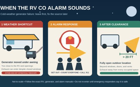
CDC recommends reducing smoke exposure, keeping smoke outside, using recirculation when a system has a fresh-air intake, and using high-efficiency filtration when the system can accommodate it.[4] Those are exposure-reduction measures, not proof that a campsite is suitable. Never run a generator, engine, grill, or other combustion device in a way that introduces carbon monoxide into an RV.
Before choosing go or hold, answer these practical questions:
- Does the campsite have hookups so you can operate your compatible air-conditioning or filtration setup without generator restrictions becoming an issue?
- Can everyone spend the smoky part of the day indoors without turning the trip into a confinement exercise?
- Is the planned activity optional, or does the trip require prolonged outdoor effort?
- Is there a confirmed cleaner destination, and can you reach it without crossing the incident or plume?
- Are pets part of the trip? CDC notes that smoke can affect animals and that some evacuation centers do not accept them.[4]
- What exact event will make you leave: a closure, a worsening trend, an AirNow category, a campground instruction, or symptoms?
A better predeparture routine
The evening before: Open the fire-and-smoke map, the incident link, land-manager alerts, road conditions, and the campground’s own notices. Look at the destination and route, not just your home ZIP code. Save screenshots or links for reference, but refresh them before acting.
Before pulling out: Repeat the check. Call the campground when conditions are changing. Ask whether the site is open, whether the normal approach road is open, whether smoke is present in the campground, and how management will contact guests if conditions change.
At the fuel stop nearest camp: Check once more while you still have room to turn toward an alternate. Do not study a map while driving.
After arrival: Identify two ways out when the road network allows it, keep the tow vehicle or motorhome ready to move, and avoid unpacking in a way that delays departure. Set a check time, such as every few hours during an active event and whenever you receive an alert or notice a visible change. The NPS advises visitors to watch for sudden weather changes and avoid traveling near a wildland fire.[5]
What AirNow cannot decide for you
AirNow can show measured or sensor-based particle conditions, recent movement, mapped fire information, and some smoke outlooks. It cannot confirm that your campground is open, that your road is passable, that a fire will not change direction, or that a specific person is medically safe at a given reading.
It also cannot replace what you can observe. If smoke is obvious at the campsite but the nearest icon is green, verify the icon’s location and update time, refresh the map, check nearby instruments, and contact local officials or campground staff. CDC advises getting medical help for new or worsening symptoms.[4] For individual risk, medication, respirator suitability, or a condition-specific travel threshold, use guidance from a qualified health professional.
The takeaway
Make the decision in the right order. Official orders and closures come first. Route and campground status come next. Then use AirNow’s current AQI, trend, nearby instruments, and Smoke Outlook to judge whether the trip still fits your group and activities.
Go when access is clear and current plus expected conditions fit the trip. Hold when uncertainty can be resolved with another update. Relocate when officials direct it, access is unsafe, or unhealthy smoke makes a discretionary stay a poor trade when a cleaner option is available.
Sources
What's Your Reaction?