












Before the Last Open Pump: Verify Fuel on a Remote RV Route
A practical verification workflow for remote fuel availability and road status, separate from loaded-range calculations and fuel-station fit checks.


Before the last open pump: verify fuel on a remote RV route
By Romana | October 5, 2026 | RV Camping
A fuel icon on a map is a lead, not a promise. On a remote route, the station may be seasonal, the store may close before the pump, diesel may be unavailable, or a card reader may lose communications. The useful trip plan records who confirmed what, when it was confirmed and what the RV crew will do if the answer changes.
This article is deliberately not a fuel-range calculation and not a test of whether a long RV fits beneath a canopy. Those questions need their own measurements. Here the job is narrower: verify that fuel is offered, learn the operating window, check the route itself and build a reserve and contact plan before service disappears.
Build a candidate list from official route information
Start with the road operator or public-land agency, not a general map search. Alaska DOT's McCarthy Road page is unusually direct: the route itself has neither a fuel station nor other services. The agency names Glennallen, Kenny Lake and Chitina as places to fuel, notes very limited cell service, and points travelers to Alaska 511 for current conditions.[1] That statement defines the problem, but it does not verify that a particular station will be open on your travel date.
The Bureau of Land Management gives similar context for the Dalton Highway. BLM says services exist in only a few places; travelers will not find medical care or a grocery store on the corridor, and cell service is extremely limited.[2] Its official corridor map adds a warning that transportation maintenance stations and pipeline pump stations do not provide public services.[3] A building near the road is not necessarily a place to buy fuel.
Make a worksheet with one row per candidate stop:
- business name and physical location or milepost;
- phone number from the operator's own site or an official route listing;
- gasoline grade required by the RV;
- diesel type if applicable;
- pump hours and staffed counter hours;
- opening and closing dates for the season;
- payment methods and whether pumps work after the office closes;
- date, time and source of the last confirmation; and
- next verified alternative before the route commits to a no-service segment.
Keep gasoline and diesel as separate fields. "Fuel available" does not establish either one. If the engine requires a specific octane or the vehicle uses diesel, ask for that exact product. Do not infer today's inventory from a directory category.
Verify the station in two passes
Check the station operator's current page or social update first. Look for a dated seasonal-opening notice, posted pump hours, product list and an after-hours phone number. Screenshots help when service disappears, but note the date because an old image can be worse than no record.
Then call. A short script prevents vague answers:
We plan to arrive in an RV on [date] around [local time]. Are your public pumps operating that day? Do you expect [regular gasoline / required grade / highway diesel] to be available? Are pump hours different from store hours? Will the pumps accept our payment method after the counter closes? Is there a known seasonal closure or delivery interruption? If that changes, where do you post the update?
Write down the employee's name or initials and the time of the call. A positive answer is a dated confirmation, not a guarantee. Deliveries, power, weather and equipment can still change.
Check the road separately from the pump
A verified station is useless if the connecting road closes. Open the transportation agency's current traveler-information system shortly before departure and again before the last reliable connection.
Alaska 511 separates current pavement reports and incidents from planned or active closures. It also maps construction, weather events and cameras.[4] The categories matter because a seasonal closure and a short incident require different responses. Save the route's text report or screenshots for offline reference, but treat them as a time-stamped snapshot.
Remote updates can lag. Alaska DOT explains that Dalton Highway crews may have to drive back to a maintenance camp before reporting conditions, and that administrative staff do not operate a round-the-clock traffic center. The agency says weekday winter reports are expected by 8 a.m., with weekend updates when conditions are difficult or worse.[5] That candor is a reason to read the timestamp, camera time and update notes instead of treating the 511 map as a live sensor.
Record four route checks:
- Is the road legally open to public travel?
- Are there seasonal gates, construction windows, ferry schedules or weather closures?
- When was each condition report or camera image updated?
- Which agency phone number can clarify an ambiguous report?
Do not call a highway maintenance camp expecting public fuel or traveler services. BLM's route material specifically says those facilities are not public service stops.[3]
Set a decision point before the no-service segment
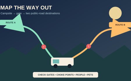
Mark the last place where the group can stop safely, contact the next station and choose another route or overnight location. That is the decision point. It should come before the road commits the RV to the remote segment, not at a locked pump in the middle of it.
At that point, confirm:
- the next planned station answered or posted a same-day operational update;
- the needed fuel product was confirmed, not merely "gas";
- the arrival time falls inside the pump's operating window;
- the road report has a usable timestamp and no conflicting closure;
- the backup stop is also open; and
- everyone knows whether the plan is continue, wait, reroute or stop for the night.
If one of those checks fails, do not turn uncertainty into confidence because a map pin remains visible. Call the alternate, ask a staffed visitor center or road authority, or stay where communications and services are available.
Define a reserve without pretending it is a range formula
A reserve plan is a decision rule. It is not a universal number of gallons and this guide does not calculate loaded range. The driver and vehicle owner must set the actual threshold using the RV's documented usable capacity, observed consumption under comparable conditions, generator or auxiliary-fuel use, weather, grades and any towing load.
Write the rule in operational terms:
- the RV does not pass the final confirmed source unless the agreed reserve remains after reaching the next verified source;
- reserve fuel is not spent on sightseeing detours;
- generator use is counted against the same supply when applicable;
- a route or headwind change triggers a new decision, not a reassuring glance at the original plan; and
- legally carried auxiliary fuel, if any, follows the vehicle maker's limits and applicable transport and campground rules.
Avoid borrowing another traveler's reserve. A gasoline motorhome, diesel pusher, truck-and-trailer combination and camper van do not share one safe threshold. If the group cannot establish a defensible reserve for its own setup, the correct plan is to shorten or change the route.
Make the backup a real plan
"Find another station" is not a backup. Record a named alternative with its own phone, hours, season and fuel product. Prefer one reached before entering the remote section. A backup on the far side of a closure does not solve the problem.
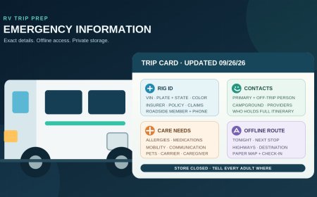
Create a contact card that works offline:
- primary station and backup station;
- road-agency or 511 number;
- public-land visitor contact when relevant;
- campground or lodging desk;
- roadside-assistance policy number and service limits;
- emergency number; and
- one out-of-area contact who has the route and check-in times.
BLM warns that the Dalton has no medical facilities or grocery stores and only scattered cell coverage.[2] Alaska DOT says the McCarthy Road has extremely limited cell service.[1] For travel like this, decide before departure whether a satellite communicator or satellite phone is appropriate. Test the device and write down who receives a missed check-in. Do not describe a maintenance office, visitor center or emergency dispatcher as roadside assistance unless that agency says it provides that service.
Coordinate a multi-vehicle group
Mixed RV groups often split up at fuel stops. Give every driver the same station names and decision point, then assign one person to update the worksheet. A trailing vehicle should not continue because the lead vehicle probably bought fuel.
Use brief status messages:
- "Primary confirmed at 9:10 a.m.; diesel available; public pump closes 6 p.m."
- "Road report updated 8:02 a.m.; no closure shown; camera image 7:48 a.m."
- "Primary did not answer; stopping at decision point and calling backup."
Those messages distinguish observation from assumption. They also give the out-of-area contact enough information to notice when the plan changes.
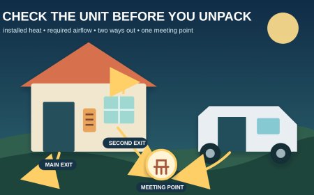
If vehicles separate, set a time and place to regroup before the no-service segment. Do not make the station driveway the meeting room. Confirm a legal pullout, campground or visitor facility where the group can wait without blocking pumps or commercial traffic.
Recheck on the travel day
Run the final review while the group still has service:
- read the road agency's current report and its timestamp;
- check alerts, future closures and weather-related notices;
- confirm pump and staffed hours in local time;
- ask for the needed grade or diesel, not generic fuel;
- call the backup;
- download or print the contact card and route snapshot; and
- send the out-of-area contact the route, decision point and next check-in.
A remote-route plan is useful because it admits that listings become stale. The aim is not to prove the pump will work. It is to replace a chain of guesses with dated confirmations, an early stop decision and people who know whom to call when one confirmation fails.
Sources
- McCarthy Road — Alaska DOT&PF route information on the no-service segment, suggested fueling communities, maintenance season and communications; accessed October 5, 2026.
- Dalton Highway — Bureau of Land Management route overview covering limited services, communications and facilities; accessed October 5, 2026.
- Dalton Highway corridor map: Fairbanks to Coldfoot — BLM map and service notes; map dated July 2, 2026; accessed October 5, 2026.
- Alaska 511 — Official current road-condition, incident, closure, roadwork, weather and camera portal; accessed October 5, 2026.
- Maintenance of the Dalton Highway — Alaska DOT&PF explanation of 511 reporting cadence and remote update limits; accessed October 5, 2026.
What's Your Reaction?