






The RV route-clearance check: four limits a car map can miss
Before driving an RV, check the whole route against the rig's real height, loaded weight, axle loads, width, length and propane setup. An RV-aware navigator helps, but official road data and posted signs make the final call.

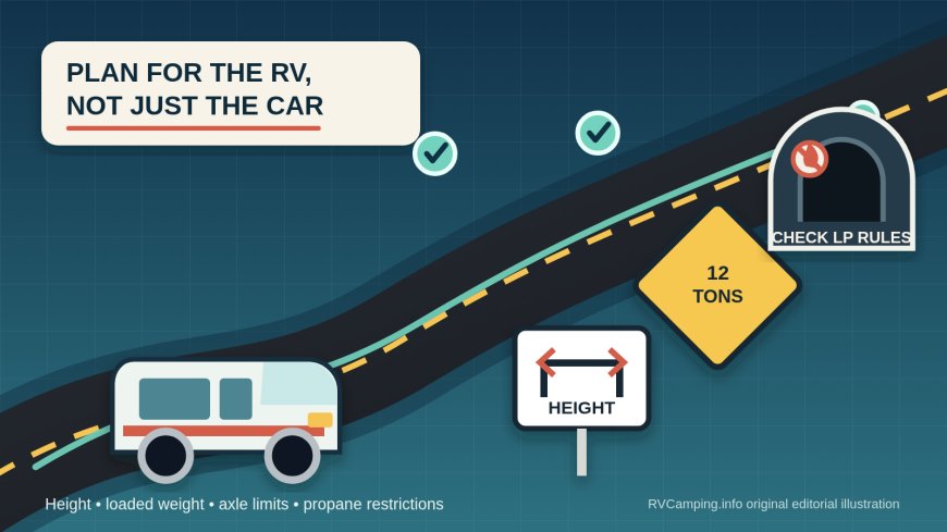

Summary: Before driving an RV, check the whole route against the rig's real height, loaded weight, axle loads, width, length and propane setup. An RV-aware navigator helps, but official road data and posted signs make the final call.
A blue line that works for a sedan may be a bad RV route. The problem is not limited to the obvious low bridge. A legal-looking shortcut can include a load-posted span, a road class that excludes your vehicle, a tunnel with propane rules, or a detour whose temporary clearance is lower than the road it replaced.
Use car navigation for traffic, arrival estimates and general orientation. Do not treat it as clearance approval. FMCSA advises commercial drivers to use navigation that accepts relevant vehicle information and still to obey low-clearance, axle-weight, detour and variable-message signs.[1] New York's parkway warning puts the gap in concrete terms: some parkway bridges are posted as low as 6 feet 11 inches.[3]
An RV trip plan needs two layers. First, create a route with a current RV- or truck-aware tool using honest vehicle data. Then audit the critical segments against the agencies and facility operators that own the roads. Neither layer replaces the signs in front of you.
Build one rig card before you build the route
Keep a note in the cab with the measurements and weights that affect routing. Do not rely on a brochure profile saved years ago. Rooftop air conditioners, vent covers, antennas, solar equipment, suspension changes, hitch equipment and a towed vehicle can change the travelling envelope.
Record:
- total height at the highest fixed point, measured on level ground;
- width at the widest permanent point, with mirrors noted separately;
- motorhome or tow-vehicle length, trailer length and total combination length;
- loaded total weight and weight carried by each axle;
- number and arrangement of axles;
- propane container size, count and whether the containers are installed or carried;
- fuel type and any other material a crossing operator may regulate.
Measure and weigh the rig in travel condition. That means the normal passengers, fuel, water level, food, bikes, tools and towed vehicle. A factory "dry weight" is not the number crossing the bridge next week. For route screening, the loaded axle readings matter because a posting or routing database may distinguish gross load from axle or vehicle configuration.
This rig card is also useful when calling a DOT, tunnel operator, campground or local public-works office. "Will my RV fit?" is hard to answer. "The combination is 12 feet 7 inches high, 8 feet 5 inches wide, 58 feet long and 27,400 pounds on three axles" gives the person something specific to check.
Clearance is more than the number on the bridge
Start with the lowest known overhead clearance on every planned leg, including campground approach roads, fuel stops and urban connectors. FHWA's route-review guidance for oversize movements calls for checking overpasses and other overhead obstructions against vehicle dimensions, then using clearance, weight and width data supplied by state DOTs.[2] RVs are not automatically oversize loads, but the method is useful.
Do not invent a private "close enough" margin. Treat the posted clearance as a limit, not an invitation to estimate pavement crown, lane position or sign conventions from the driver's seat. Clearance may vary by lane under an arched bridge. Fresh pavement, temporary work platforms, snow or a suspension change can also make an old measurement less useful.
If the planned clearance looks close to the measured rig height, choose another road or obtain confirmation from the road owner before departure. Street-level imagery can help identify where to investigate, but an old image is not authoritative clearance data.
Parkway and road-class restrictions deserve their own check. A route can be physically tall enough at one point and still be prohibited by signs or vehicle classification. NYSDOT says its parkways were designed for automobiles and warns commercial vehicles away from the system.[3] Whether a particular motorhome, converted vehicle or tow combination is legally classified the same way depends on the jurisdiction and registration. Do not stretch a truck rule into a nationwide RV rule; check the named road and your vehicle's status.
Read weight signs with your loaded numbers in hand
"Under GVWR" does not prove that every bridge is available. A local bridge can have a posted tonnage below the RV's actual loaded weight. Other signs may distinguish single vehicles from combinations or show different limits for different vehicle configurations.
New York's posted-bridge tool illustrates the point. It defines a posted-load bridge as one carrying a specific limit in tons and says vehicles above that posted weight are prohibited, even when they hold an overweight permit.[4] The same page also warns that its local-government bridge data does not carry the same confidence as data for NYSDOT and partner-owned structures.[4] Database coverage itself has boundaries.
For a route audit:
- Compare loaded gross and axle weights with every posted restriction.
- Check the state DOT or 511 system for the main route and alternates.
- Look for county, town or facility-owner notices on the final miles.
- Recheck after a major detour, construction alert, flood, wildfire or spring-thaw restriction changes the road network.
- If the meaning of a sign is unclear, stop somewhere safe before the restricted structure and contact the responsible agency.
Never use a passenger-car reroute to "get around" a weight posting. It may simply send the RV toward another restricted bridge or a street with no safe turnaround.
Propane rules attach to the crossing, not to your destination
Propane restrictions are a good test of whether a routing workflow is truly RV-aware. The navigation question is not merely whether a tunnel is open. It is whether that facility permits this vehicle with these containers, in this quantity, under today's operating rules.
Maryland's two Baltimore highway tunnels show how specific a rule can be. MDTA says vehicles carrying bottled propane in DOT-approved containers larger than 10 pounds are prohibited from both the I-95 Fort McHenry Tunnel and the I-895 Baltimore Harbor Tunnel; it lists a maximum of ten 10-pound containers and says the rule applies whether bottles are empty or full.[5] The agency directs affected vehicles to the western section of I-695.[5]
The same MDTA notice gives separate size limits for the two tunnels: vehicles over 13 feet 6 inches high or 8 feet wide are prohibited from I-895, while the I-95 tunnel limits listed there are 14 feet 6 inches high and 11 feet wide.[5] That does not create a general Maryland rule, much less a national one. It is a facility-specific example of why "avoid tunnels" and "propane off" are not reliable universal shortcuts.
Before a route enters any tunnel, bridge-tunnel, ferry or enclosed facility, read the current operator page. Check container capacity, total quantity, valve or flame instructions, inspection requirements, vehicle-fuel exceptions and the stated alternate. If the published language does not squarely cover your setup, call the operator. Save the page or note the answer, the date and the contact number in the trip plan.
Turning a valve off may be required in some places, but it does not cure a prohibition based on possession, container size or quantity. Maryland expressly counts the affected bottles whether empty or full.[5]
Why an RV navigator is useful but never final
A proper RV routing tool can reject roads based on height, weight, width, length and sometimes propane or hazardous-material settings. A car app usually does not ask for that profile. That difference matters, but an "RV-safe" label still cannot promise that every local bridge, private campground road or temporary restriction is complete and current.
FMCSA's guidance makes the hierarchy clear: enter the relevant vehicle information, keep maps updated and obey signs and advisories.[1] FHWA also points route planners toward state DOT restriction data rather than treating the navigation screen as the only record.[2]
Use this order of authority while driving:
- law-enforcement or road-crew direction;
- current traffic-control devices and posted signs;
- facility-operator and road-owner notices;
- the pre-trip route audit;
- the navigation suggestion.
When the screen and the sign disagree, stop before the constraint if that can be done safely. Do not continue while trying to settle the dispute on a phone. A missed turn costs time. Passing the last safe exit before a low bridge can leave no easy recovery.
A 15-minute clearance audit for each travel day
Run this check the evening before departure, then refresh it before moving:
- Load the correct rig profile and confirm units: feet versus meters, pounds versus tons.
- Scan the complete route, not just the next instruction.
- Mark every tunnel, bridge-tunnel, ferry, parkway and non-Interstate shortcut.
- Check state 511 and DOT restriction pages for both the primary route and one realistic alternate.
- Verify low clearances and bridge postings on the final approach to fuel, food, overnight stops and campgrounds.
- Read the facility operator's current propane and size rules where applicable.
- Compare every number with the rig card; do not compare from memory.
- Download or print the critical notices and maps for weak-signal areas.
- Write down the last safe exit before any questionable segment.
- Keep enough fuel and time to take the longer legal route.
For a tight campground approach, ask the campground for the route used by comparable rigs and whether recent construction has changed it. Treat that local advice as one input, then reconcile it with posted signs. A host may know the best entrance while still not knowing your exact height or axle loads.
If you meet an unexpected restriction
Slow down without making an abrupt move. Use the last safe pull-off or exit. Turn on hazard flashers as conditions require, and contact the road authority or police if the vehicle cannot proceed without blocking traffic. Do not attempt an improvised U-turn, reverse on a freeway ramp or have a passenger stand in live traffic to "spot" a low bridge.
The useful route is not the shortest blue line. It is the route that still works after the RV's dimensions, loaded weights, road classifications and carried propane are applied to every leg. Build the profile once, verify the exceptions before each travel day, and let the sign win.
Source note: This guide was developed from current FMCSA and FHWA route-planning guidance plus facility-specific information from NYSDOT and the Maryland Transportation Authority. Rules and road conditions can change; verify the agencies responsible for the exact route immediately before travel.
Sources
What's Your Reaction?