






Before the tracks: route a low-clearance RV around hang-up crossings
A route-planning check for long-wheelbase and low-clearance RVs: find at-grade crossings, read low-clearance warnings, confirm far-side storage, preserve a detour and know what to do if the rig hangs up.

Before the tracks: route a low-clearance RV around hang-up crossings
By Romana | October 6, 2026 | RV Camping
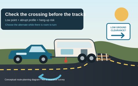
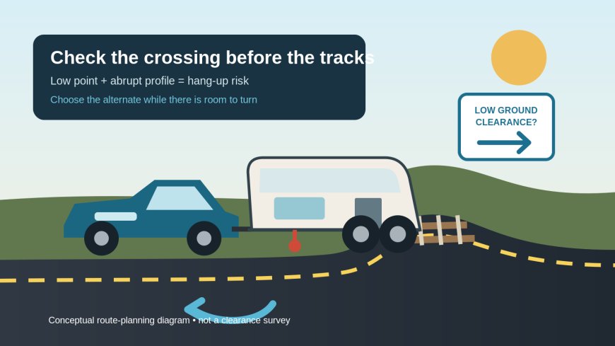
A railroad crossing can clear the roof and still trap the middle of an RV. The problem is the road profile: the tow vehicle climbs over the rails, the trailer starts up the same rise, and the low point between the axles settles onto the crossing. Long wheelbases, low plumbing, stabilizer hardware and low trailer frames deserve a separate route check from the usual bridge-height review.
The assigned fuel-stop topic is already represented in RVCamping.info's corpus by the October 4 guide, "Before you turn in: scout a fuel stop for a long or tall RV." This package takes a different route-planning problem: avoiding a railroad-crossing hang-up and preserving a usable detour before the rig reaches the tracks.
Know which part of the rig is vulnerable
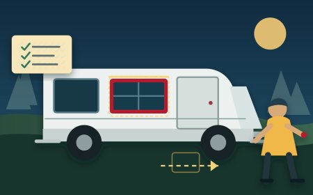
Start with the combination in travel condition. Record the connected length, wheelbase or axle spacing, and the lowest fixed components beneath the motorhome or trailer. A low hitch component, tank, drain assembly, spare-tire carrier or stabilizer can matter even when the body looks high. Use the RV, chassis and hitch manuals for approved measurements and operating limits; do not crawl under an unsupported vehicle or improvise a clearance test in traffic.
This is not the same question as overhead clearance. Federal Motor Carrier Safety Administration guidance calls out long-wheelbase and low-ground-clearance vehicles as special cases at highway-rail crossings.[1] The current federal traffic-control manual is more explicit: it lists recreational vehicles among the combinations that can hang up where a crossing profile is abrupt.[5]
A route note should therefore carry two separate lines:
- Top clearance: measured travel height to the highest fixed point.
- Underbody risk: the lowest fixed point, where it sits between axles, and any manufacturer warning about steep crests or abrupt grade changes.
A single "RV-friendly" label does not answer either line.
Find every at-grade crossing on the planned route
Review the full connected route, including campground entrances, fuel or grocery side trips and the last few local miles. The FRA Rail Crossing Locator can search by address, geolocation or U.S. DOT Crossing ID and shows records drawn from information submitted by states and railroads.[4] Use it to identify crossings that a general road map may not make obvious.
Treat the locator as an inventory tool, not a fit certificate. It can establish that a crossing exists and supply useful crossing details. It does not certify that your RV's underbody will clear today's pavement profile. Construction, resurfacing and a trailer's particular geometry can change the answer.
For each at-grade crossing, make a small route card:
- Road name and direction of travel.
- U.S. DOT Crossing ID, if available.
- Nearest safe decision point before the tracks.
- Alternate crossing or road that stays on a verified RV-suitable route.
- Road authority and railroad contact details for unresolved questions.
Do this before departure, not while stopped on the approach.
Read the warning as a detour decision
The yellow Low Ground Clearance crossing sign (W10-5) exists for an abrupt highway profile that can create a hang-up for a long-wheelbase vehicle or low trailer. The 2023 MUTCD says the symbol should be accompanied initially by a LOW GROUND CLEARANCE plaque and notes that additional messages may identify vehicle types.[5]
A posted warning means use the planned alternate. It is not an invitation to edge forward until a spotter guesses at the gap. The same federal manual recommends advance plaques such as USE NEXT CROSSING and a signed detour where appropriate.[5]
The absence of that sign does not prove an RV will fit. Signing follows engineering decisions, and conditions can be changed or newly damaged. Escalate the crossing for confirmation when any of these show up during pre-trip review:
- a sharp rise to the rails followed by an immediate drop;
- scrape marks in pavement near the crown;
- a low-clearance warning in either approach direction;
- an intersection, signal or queue immediately beyond the tracks;
- recent road work or an image whose capture date cannot establish current conditions;
- no forward escape if the driver declines the crossing.
Satellite and street-level images can expose questions, but they cannot measure breakover clearance or confirm present pavement. Do not derive a safe crossing angle from imagery.
Ask the agency a question it can answer
For a questionable public crossing, contact the road authority listed for that road and, when directed, the railroad. Give the road name, approach direction, U.S. DOT Crossing ID and the exact type of combination. Explain that the concern is underbody hang-up at the crossing profile, not bridge height.
Ask whether the crossing has a low-ground-clearance restriction or warning, whether recent work changed the approaches, and which nearby public crossing is the designated alternate. If the answer is uncertain, route around it. Do not ask an employee to promise that "an RV" will fit; a short Class B and a long fifth-wheel do not present the same geometry.
FMCSA notes that some states require advance railroad notification for slow-moving or low-clearance permitted loads.[1] Most privately used RVs are not permitted oversize loads, but the point still matters: do not borrow procedures meant for specialized hauling or enter a private crossing without coordinating with its owner and the railroad.
Check storage space beyond the rail
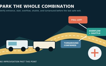
A crossing can be flat enough and still be unusable because traffic stops on the far side. FMCSA's driver guidance says not to enter unless the vehicle can pass completely through without stopping, leaving the back of the vehicle at least 6 feet beyond the farthest rail.[2] That means the route card must include the entire connected length, not only the motorhome or trailer.
Before moving, verify that the exit lane has room for the whole rig. A red light, stop sign, roundabout queue, gate, campground check-in line or left-turn backup can consume the storage space beyond the tracks. Wait on the approach side. Never count on the queue moving before a train arrives.
The safest alternate may be several minutes longer. That is cheap compared with finding the trailer balanced on the rails or the rear of a towed car still inside the track area.
Make the go/no-go call before the approach narrows
Use a hard decision sequence:
- Known crossing, known fit, clear exit: continue only when rail signals, gates and traffic allow.
- Posted low-clearance warning: take the planned detour.
- Profile looks different from the precheck: stop at a legal place before the crossing and use the alternate.
- No room beyond the farthest rail: wait before the tracks.
- No safe place to stop or turn around near the approach: the route plan failed too late; continue only on a legal road that avoids entering the crossing and rebuild the route from a safe parking area.
Do not make a roadside U-turn with a long combination simply because a warning appears. The backup route must start at a junction where the turn is legal and the whole rig fits.
Cross at the road's lawful speed and follow posted instructions. Do not stop on the rails, change gears there, or steer onto a shoulder to attack the crossing diagonally. An improvised diagonal line can put the rig into opposing traffic, strike equipment beside the track or leave it exposed for longer.
If the RV hangs up, leave it
If the vehicle stalls or becomes stuck on the tracks, get everyone out immediately. Move away from the tracks; once clear, use the blue-and-white Emergency Notification System sign to call the railroad, give the U.S. DOT Crossing ID and describe the emergency. FRA says the sign's number reaches the responsible railroad and the crossing ID identifies the exact location.[3] Call 911 as well when needed.
FMCSA's emergency steps put evacuation first, before locating the sign or making the call.[2] Do not remain aboard to operate jacks, disconnect a trailer, retract equipment or diagnose the problem. Property can be replaced. The people and pets need distance from the tracks.
A passenger can photograph the ENS sign from a safe public position during a planned stop before the trip, or the route card can carry the crossing ID and emergency contact from official records. That preparation saves time, but it never replaces reading the sign at the actual crossing because the posted information controls the emergency response.
The route card to keep by the driver
Write one line for every crossing that required review:
Road and direction | Crossing ID | clear/avoid/unresolved | far-side storage checked | alternate junction | road authority contact
Mark unresolved as avoid until an authoritative answer changes it. Recheck the route after road closures, construction notices or a campground's arrival directions change. Navigation can suggest another street after a missed turn; it does not know the RV's lowest fixed point.
The practical rule is plain: resolve the crossing while there is still somewhere else to go. A low-clearance RV should arrive at the tracks with a confirmed path and an empty far side, not a clearance experiment.
Source note: This article applies federal crossing-safety, traffic-control and inventory guidance to private RV route planning. It does not claim an on-site inspection or guarantee that any particular crossing fits a particular vehicle. Confirm vehicle limits in the applicable manuals and current crossing conditions with the responsible authorities.
Sources
- Highway-Rail Grade Crossing Safety: Special Situations | FMCSA — Official precautions for long-wheelbase and low-ground-clearance vehicles.
- 7 Steps for Safety - Highway-Rail Grade Crossings | FMCSA — Official complete-clearance and emergency-evacuation guidance.
- Emergency Notification Systems at Highway-Rail Grade Crossings | FRA — Official explanation of the blue ENS sign, railroad number and crossing ID.
- Rail Crossing Locator App | FRA — Official crossing inventory search scope and data provenance.
- Manual on Uniform Traffic Control Devices, 11th Edition, Part 8 | FHWA — Sections 8B.16 and 8B.27 on low-ground-clearance warnings, detours and ENS signs.
What's Your Reaction?