







RV trip weather checkpoints: a go, hold, or reroute plan
Use four weather checkpoints to compare NWS alerts with official 511 road conditions and make a clear go, hold, or reroute decision for each RV travel leg.

RV trip weather checkpoints: a go, hold, or reroute plan
By Romana
Category: RV Camping
A weather check should end with a decision, not twelve open radar tabs. For an RV trip, the useful answer is whether a specific road segment is still a go, needs a pause, or should be replaced with another route.
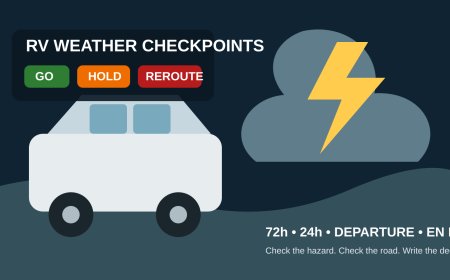
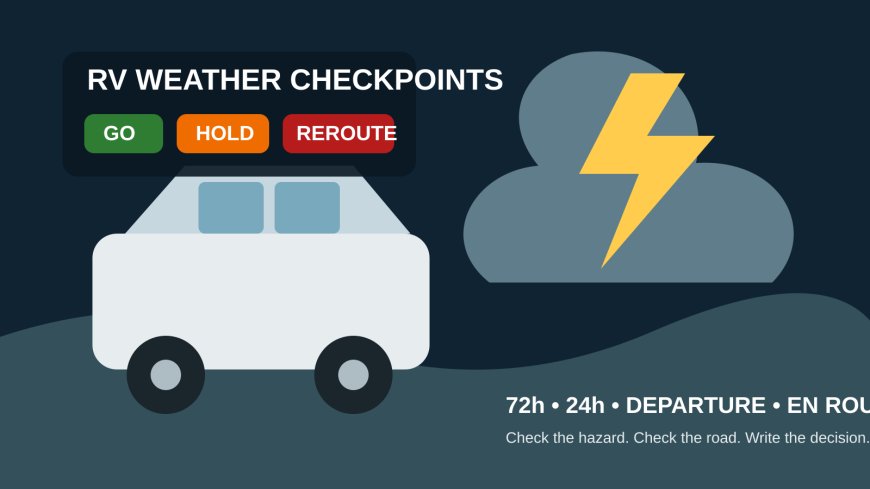
This four-checkpoint plan covers the whole travel day: 72 hours before departure, 24 hours out, at departure, and en route. It combines National Weather Service alerts and hourly forecasts with the road closures, restrictions, cameras, and reports published by state 511 or DOT systems. FHWA describes 511 as a nationwide number for current travel conditions, while implementation details remain with state and local agencies.[5] That is why the road source in this plan is always the official service for the state you are actually driving through.
The triggers below are an RVCamping.info planning policy, not official wind limits for every RV. A motorhome, fifth wheel, and small camper van do not respond alike. Your owner's manual, tire and weight limits, driver comfort, insurer rules, law-enforcement directions, and a posted vehicle restriction can all require an earlier stop.
Start one decision log for the trip
Use a note on the driver's phone, a shared document, or one sheet on a clipboard. Create one row for each travel leg, usually the stretch between fuel or rest stops. Record:
- the road, direction, start and end points;
- planned entry and exit times, with time zone;
- NWS alert name, affected area, start, end, and instruction;
- hourly wind, gust, precipitation, visibility, and temperature cues;
- official 511/DOT closure, restriction, incident, or camera observation;
- the decision: GO, HOLD, or REROUTE;
- the reason in one sentence; and
- the time and place of the next check.
A screenshot can help when reception disappears, but write down its time. An old road map or warning image is evidence of what you saw earlier, not proof that the road is still open.
Use the labels consistently:
- GO means no trip trigger is active and the next check is scheduled.
- HOLD means stay where the RV can remain safely parked while you wait for a warning, road restriction, or uncomfortable condition to clear.
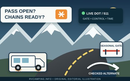
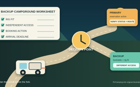
- REROUTE means replace the affected road segment. Do not use a detour merely because a general navigation app suggests it; verify the replacement on each state's official road system and check its forecast too.
Checkpoint 1: 72 hours before departure
Draw the trip as a sequence of places, not a single forecast at the destination. Check the departure area, each major junction, exposed open-country segment, fuel stop, overnight stop, and destination. The NWS Hourly Weather Graph can show an hour-by-hour forecast as far as seven days ahead.[7] At this stage, use it to find the timing of wind shifts, storm windows, and daytime heat rather than treating one daily icon as the whole route.
Open the NWS active-alert view for every state on the route. A technical user can query the official API by state with /alerts/active?area= and the two-letter state code.[8] Read the actual alert, including its area, valid period, impacts, and protective action. A colored map by itself does not say whether your road or travel hour is involved.
For heat, check the NWS HeatRisk layer alongside formal alerts. HeatRisk looks ahead seven days and considers how unusual the heat is, its duration, warm nights, and health thresholds.[3] NWS also labels HeatRisk experimental and not supported around the clock, so it supplements rather than replaces watches, warnings, and advisories.[3]
Then save the official 511/DOT page or app for every state. Find where that system displays closures, high-profile-vehicle restrictions, flood reports, construction, cameras, and message signs. Do not assume the same layers or terminology appear after the state line.
72-hour decision triggers
GO when no watch or warning overlaps a planned leg, the state road source shows the intended roads open, and the forecast leaves enough margin for the rig and driver. Log the next check for 24 hours before departure.
HOLD the itinerary when a High Wind Watch, flood watch, severe-weather risk period, or Extreme Heat Watch overlaps a travel leg and timing remains uncertain.[1][9] A High Wind Watch means strong sustained winds are possible and plans may need adjustment.[1] Keep reservations flexible; do not commit to a narrow departure window yet.
REROUTE in planning when an official DOT closure or vehicle restriction already blocks the route, or when the only plan depends on a low-water crossing or another road likely to be unavailable during the forecast hazard. Check the alternate from scratch. A longer line on the map is not safer if it crosses the same storm two hours later.
Checkpoint 2: 24 hours before departure
Now match forecast hours to driving hours. For each leg, note the highest forecast gust, the direction of the wind relative to the road, heavy-rain timing, thunderstorm timing, expected visibility, daytime heat, and the overnight temperature at the stop. The hourly graph lets you select weather elements and inspect separate 48-hour periods, which is more useful than a daily high and a weather icon.[7]
Wind deserves a rig-specific reading. NWS Wind Advisories and High Wind Warnings use local criteria, not one national number.[1] Record the alert name and forecast gusts, then apply the more conservative of your written trip limit, the RV maker's guidance, a posted restriction, or the driver's comfort. Crosswinds on an exposed bridge or open plain may force a stop before a sheltered headwind would.
Flood decisions are simpler. Never drive around a flood barricade or enter water across a road. NWS warns that water can conceal a collapsed roadbed and says 12 inches of rushing water can carry away most cars; two feet can move SUVs and trucks.[2] An RV's size is not a reason to test an unknown crossing.
Heat planning must include the parked hours. An Extreme Heat Warning means dangerously hot conditions are expected or occurring; NWS recommends staying in air conditioning as much as possible, including overnight.[9] Confirm the campground's power status, generator rules, fuel, cooling system operation, pet plan, medications, and a nearby cooled building. A reservation is not a heat plan.
24-hour decision triggers
GO when the roads remain open, no stop trigger affects the driving window, and the crew has a written next-check point. If an advisory is present but below the rig's predetermined limit, write the condition beside GO rather than quietly forgetting it.
HOLD if a High Wind Warning is expected to cover the road while you would be on it; if severe thunderstorms are forecast for the only exposed travel window; or if dangerous heat overlaps the stop and the RV has no verified cooling and backup. NWS treats a High Wind Warning as a take-action product and advises drivers to slow down and keep both hands on the wheel.[1] For this trip policy, an affected RV waits outside that warning window instead of using the warning as a cue to press on more slowly.
REROUTE for an official closure, high-profile-vehicle restriction, evacuation route conflict, or flood report on the planned road. Reroute to dependable pavement and services, then run the weather and road checks again for the alternate.
Checkpoint 3: at departure
Do this check before the engine starts, not while merging. Refresh the NWS alert and state 511/DOT pages. Read any new alert text. Confirm that the first two road legs are open and review current cameras where the state provides them. Compare the latest hourly wind and storm timing with yesterday's log.
Make sure Wireless Emergency Alerts are enabled on at least two compatible phones if possible. WEA messages come from authorized government alerting authorities and require no subscription on capable devices.[6] They are an alarm layer, not a complete briefing: NWS says to follow the message and seek details from a trusted weather source.[6]
Do the RV walkaround with the forecast in mind. Secure the awning, hatches, cargo, bikes, antenna, and anything that can catch wind. Confirm tires, hitch, safety chains, breakaway cable, lights, mirrors, fuel, drinking water, and charged phones. This inspection does not cancel a weather trigger; it makes a GO decision less fragile.
Departure decision triggers
GO only after one driver says the decision aloud: "GO to [next stop], next check at [time/place]." The log should show fresh timestamps for both weather and roads.
HOLD when a High Wind Warning, Severe Thunderstorm Warning, Flash Flood Warning, Tornado Warning, or other NWS warning with immediate protective action covers the first travel leg. A Severe Thunderstorm Warning means dangerous weather has been observed or detected, and NWS directs people to shelter in a substantial building rather than a mobile home.[4] An RV is not the substantial shelter named in that guidance.
REROUTE when the DOT system shows a closure or restriction, or when emergency instructions direct traffic away from the route. Follow the official detour. Do not route around a barricade on an unverified local road.
Checkpoint 4: en route
The passenger handles updates while the vehicle is moving. If the driver is alone, checks happen only when safely parked. Recheck at every fuel or driver stop, before entering the next state, and at least every two hours when weather is changing. Record the source and time again.
A WEA may arrive after you enter a threat area.[6] Do not read a long alert at the wheel. Pull into a safe parking location when conditions allow, then read the instruction and open the full NWS warning. If the alert calls for immediate shelter, follow that instruction first.
Watch the road as well as the phone. Spray crossing the centerline, standing water, dust, rapidly falling visibility, trucks leaving the road, or repeated steering corrections are reasons to leave the travel lane at the next safe place. They are not proof that the next five miles will improve.
En-route decision triggers
Continue GO only while the logged route remains open, no warning or restriction applies, the rig tracks normally, and the driver has comfortable control. Set the next check before moving again.
HOLD at the nearest safe off-road location when wind requires repeated steering correction, visibility is deteriorating, lightning or hail is approaching, heat is affecting a person or pet, or a warning overlaps the road ahead. A watch means prepare; a warning means act. If a tornado or severe thunderstorm warning calls for substantial shelter, identify the building rather than remaining in the RV.[4]
REROUTE for a closed or restricted road, water over the roadway, an evacuation instruction, or an official detour. Never make the flooded road itself a checkpoint. Turn back before the water and use the DOT-confirmed alternate.[2]
If all alternates cross the same hazard, the decision is HOLD. "No useful reroute" is a valid log entry.
Copy this compact decision block
Time and location:
Leg:
NWS alert and valid time:
Wind/gust, rain, visibility, heat cue:
State 511/DOT status and timestamp:
Decision: GO / HOLD / REROUTE
Reason:
Next check:
The point of four checkpoints is not to predict every storm perfectly. It is to keep one stale forecast, one tempting detour, or one paid reservation from making the decision for you. Check the hazard, check the road, write the trigger, and leave yourself a safe place to change the answer.
Editorial note: This is a general multi-hazard trip-decision framework. It does not set a universal safe wind speed or replace an owner's manual, official warning instruction, road closure, evacuation order, or emergency direction. Wildfire smoke exposure and mountain-pass operations require their own route-specific plans and are outside this article's scope. Official sources were checked September 23, 2026. No firsthand driving test is claimed.
Sources
- National Weather Service: Wind Warnings, Watches and Advisories — Accessed September 23, 2026.
- National Weather Service: Turn Around Don't Drown® — Accessed September 23, 2026.
- National Weather Service: Heat Forecast Tools — Accessed September 23, 2026.
- National Weather Service: Understand Severe Weather Alerts — Accessed September 23, 2026.
- Federal Highway Administration: About 511 — Accessed September 23, 2026.
- National Weather Service: Weather warnings on the go! — Accessed September 23, 2026.
- National Weather Service: Get your hourly weather forecast — Accessed September 23, 2026.
- National Weather Service: API Web Service — Accessed September 23, 2026.
- National Weather Service: Understanding Heat Alerts — Accessed September 23, 2026.
What's Your Reaction?